File:Goosenecks SP01.jpg

Size of this preview: 800 × 533 pixels. Other resolutions: 320 × 213 pixels | 640 × 427 pixels | 1,024 × 683 pixels | 1,280 × 853 pixels | 2,520 × 1,680 pixels.
Original file (2,520 × 1,680 pixels, file size: 3.66 MB, MIME type: image/jpeg)
Captions
Captions
Add a one-line explanation of what this file represents
Summary
edit
| Description |
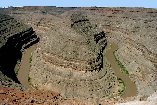
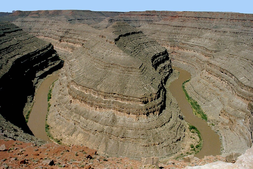
English: Goosenecks State Park is located near Mexican Hat in southeastern Utah, United States. View to San Juan River.
(Geology)-The Honaker Trail Formation-(slopes), lie upon the inner canyon (cliffs & slopes), of the en:Paradox Formation. Deutsch: DerGoosenecks State Park|Goosenecks State Park liegt bei Mexican Hat im südöstlichen Utah, Vereinigte Staaten. Im Bild: Blick zum San Juan River. |
| Date | |
| Source | Own work |
| Author | Nikater |
| Permission (Reusing this file) |
Own work, all rights released (Public domain) |
Licensing
edit
| I, the copyright holder of this work, release this work into the public domain. This applies worldwide. In some countries this may not be legally possible; if so: I grant anyone the right to use this work for any purpose, without any conditions, unless such conditions are required by law. |
File history
Click on a date/time to view the file as it appeared at that time.
| Date/Time | Thumbnail | Dimensions | User | Comment | |
|---|---|---|---|---|---|
| current | 08:25, 4 March 2012 | | 2,520 × 1,680 (3.66 MB) | Nikater (talk | contribs) | == {{int:filedesc}} == {{Information |Description={{en|1=Goosenecks State Park is located near Mexican Hat in southeastern Utah, United States. View to the entrance of the park.}} {{de|1=Der[[:de:Goosenecks State Park|Goo... |
You cannot overwrite this file.
File usage on Commons
There are no pages that use this file.