File:Goteik viaduct.svg

Size of this PNG preview of this SVG file: 596 × 488 pixels. Other resolutions: 293 × 240 pixels | 586 × 480 pixels | 938 × 768 pixels | 1,251 × 1,024 pixels | 2,501 × 2,048 pixels.
Original file (SVG file, nominally 596 × 488 pixels, file size: 533 KB)
Captions
Captions
Add a one-line explanation of what this file represents
| Description |
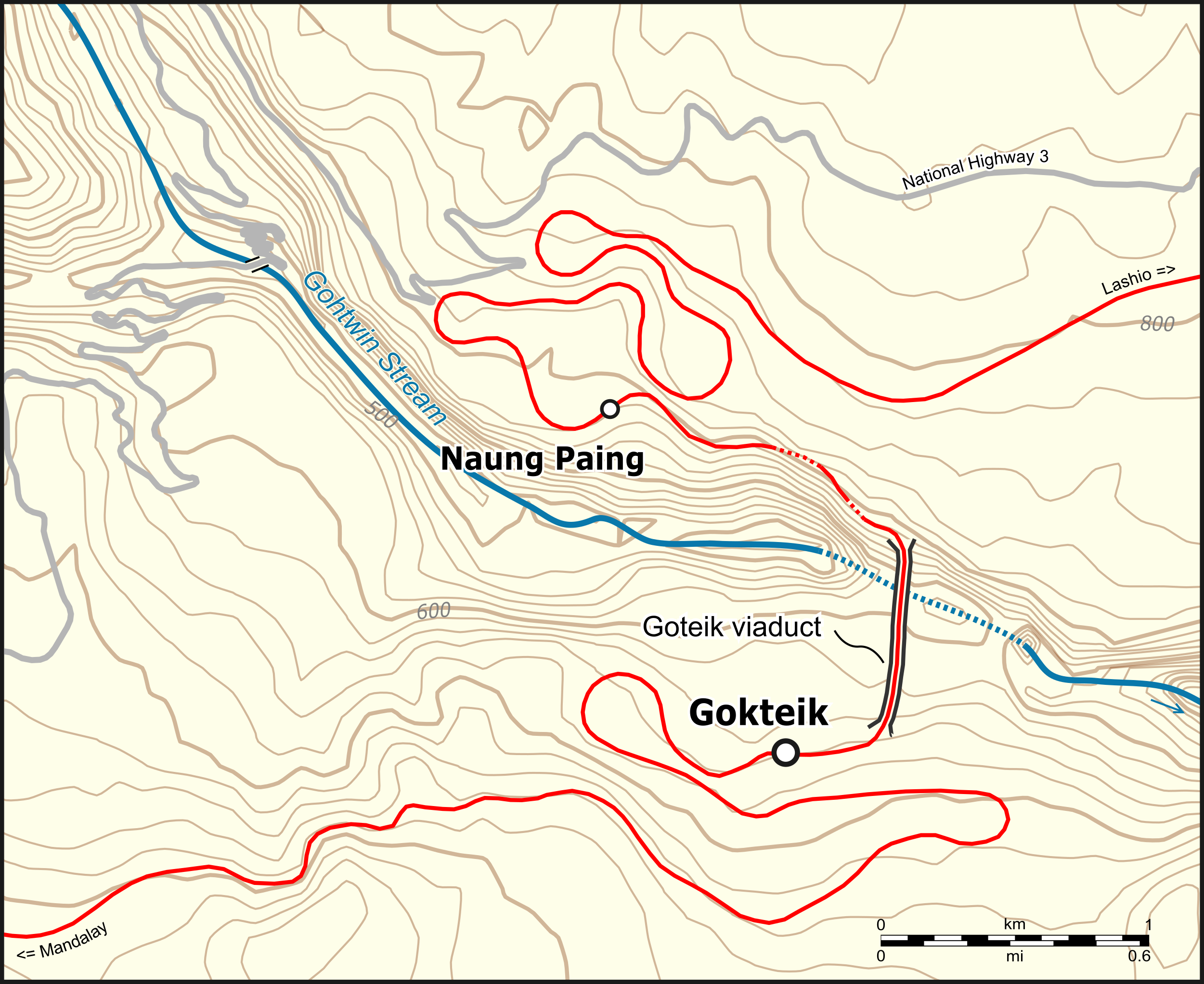
Deutsch: Lagekarte des Goteik-Viaduktes English: Location map of the Goteik viaduct |
|||||||||
| Date | ||||||||||
| Source | Open Street Map | |||||||||
| Creator | ||||||||||
| Permission (Reusing this file) |
Map data (c) OpenStreetMap (and) contributors, CC-BY-SA | |||||||||
| Geotemporal data | ||||||||||
| Bounding box |
|
|||||||||
This file is licensed under the Creative Commons Attribution-Share Alike 2.0 Generic license.
- You are free:
- to share – to copy, distribute and transmit the work
- to remix – to adapt the work
- Under the following conditions:
- attribution – You must give appropriate credit, provide a link to the license, and indicate if changes were made. You may do so in any reasonable manner, but not in any way that suggests the licensor endorses you or your use.
- share alike – If you remix, transform, or build upon the material, you must distribute your contributions under the same or compatible license as the original.
File history
Click on a date/time to view the file as it appeared at that time.
| Date/Time | Thumbnail | Dimensions | User | Comment | |
|---|---|---|---|---|---|
| current | 12:49, 21 August 2016 | | 596 × 488 (533 KB) | Pechristener (talk | contribs) | {{Map |Description={{de|1=Lagekarte des Goteik-Viaduktes}}{{en|1=Location map of the Goteik viaduct}} |Source = [http://www.openstreetmap.org/ Open Street Map] |Author = [[User:Pechristener|... |
You cannot overwrite this file.
File usage on Commons
The following 4 pages use this file:
File usage on other wikis
The following other wikis use this file:
- Usage on de.wikipedia.org