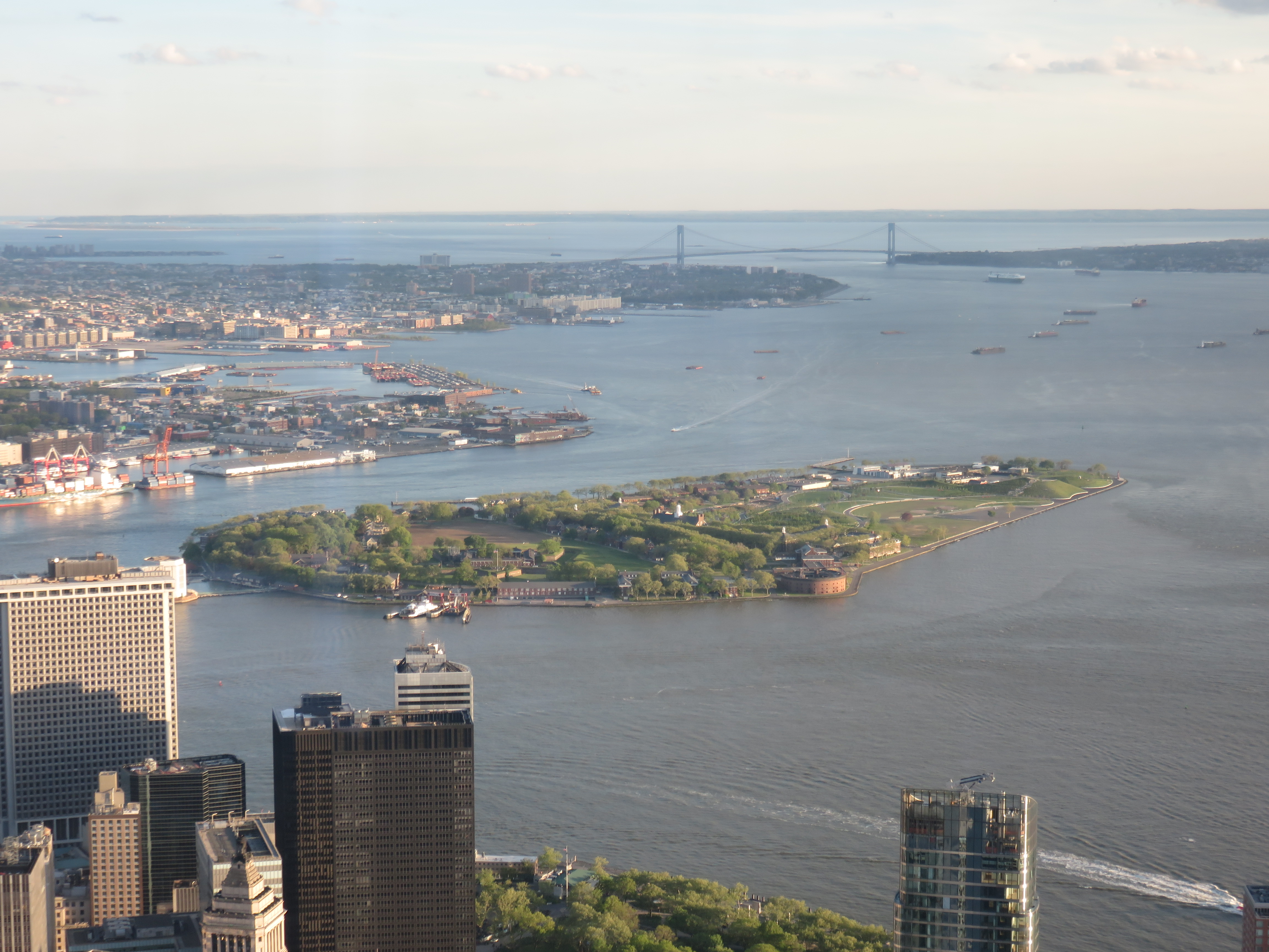
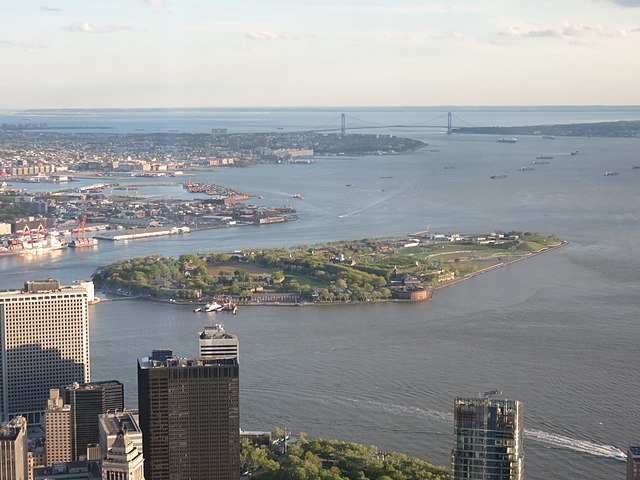
File:Governors Island from One World Observatory 2017.jpg
Size of this preview: 800 × 600 pixels. Other resolutions: 320 × 240 pixels | 640 × 480 pixels | 1,024 × 768 pixels | 1,280 × 960 pixels | 2,560 × 1,920 pixels | 4,608 × 3,456 pixels.
Original file (4,608 × 3,456 pixels, file size: 3.41 MB, MIME type: image/jpeg)
Captions
Captions
Add a one-line explanation of what this file represents
Summary edit
| Description | |
| Date | |
| Source | Own work |
| Author | Antony-22 |
| Camera location | | View this and other nearby images on: OpenStreetMap |
|---|
Licensing edit
I, the copyright holder of this work, hereby publish it under the following license:
This file is licensed under the Creative Commons Attribution-Share Alike 4.0 International license.
- You are free:
- to share – to copy, distribute and transmit the work
- to remix – to adapt the work
- Under the following conditions:
- attribution – You must give appropriate credit, provide a link to the license, and indicate if changes were made. You may do so in any reasonable manner, but not in any way that suggests the licensor endorses you or your use.
- share alike – If you remix, transform, or build upon the material, you must distribute your contributions under the same or compatible license as the original.
File history
Click on a date/time to view the file as it appeared at that time.
| Date/Time | Thumbnail | Dimensions | User | Comment | |
|---|---|---|---|---|---|
| current | 05:19, 29 June 2017 | | 4,608 × 3,456 (3.41 MB) | Antony-22 (talk | contribs) | User created page with UploadWizard |
You cannot overwrite this file.
File usage on Commons
The following 2 pages use this file:
File usage on other wikis
The following other wikis use this file:
- Usage on arz.wikipedia.org
- Usage on de.wikipedia.org
- Usage on en.wikipedia.org
- Ellis Island
- Long Island
- Manhattan
- Roosevelt Island
- Staten Island
- Coney Island
- City Island, Bronx
- Liberty Island
- Governors Island
- Isle of Meadows
- Prall's Island
- Barren Island, Brooklyn
- Pelham Bay Park
- Rikers Island
- Shooters Island
- Broad Channel, Queens
- U Thant Island
- North and South Brother Islands (New York City)
- High Island (Bronx)
- Hart Island
- Pelham Islands
- Rat Island (Bronx)
- The Blauzes
- Chimney Sweeps Islands
- Green Flats Reef
- Cuban Ledge
- Hoffman Island
- Hunter Island (Bronx)
- Swinburne Island
- Mill Rock
- Randalls and Wards Islands
- Mill Basin, Brooklyn
- Geography of New York City
- List of smaller islands in New York City
- Template:New York City Islands
- Port of New York and New Jersey
- Bergen Beach, Brooklyn
- National Register of Historic Places listings in Manhattan on islands
- List of islands of New York (state)
- Canarsie Pol
- Ruffle Bar
- Mau Mau Island
- Berrien's Island
- Mussel Island
- User:Oladin ku/sandbox
- Little Island at Pier 55
- User:Antony-22/Gallery/New York
View more global usage of this file.