File:Gran Logia de la Masonería del Uruguay (4).jpg
Size of this preview: 800 × 450 pixels. Other resolutions: 320 × 180 pixels | 640 × 360 pixels | 1,024 × 576 pixels | 1,280 × 720 pixels | 3,264 × 1,836 pixels.
Original file (3,264 × 1,836 pixels, file size: 1.12 MB, MIME type: image/jpeg)
Captions
Captions
Add a one-line explanation of what this file represents
Summary
edit.jpg&action=edit§ion=1)
| Description |
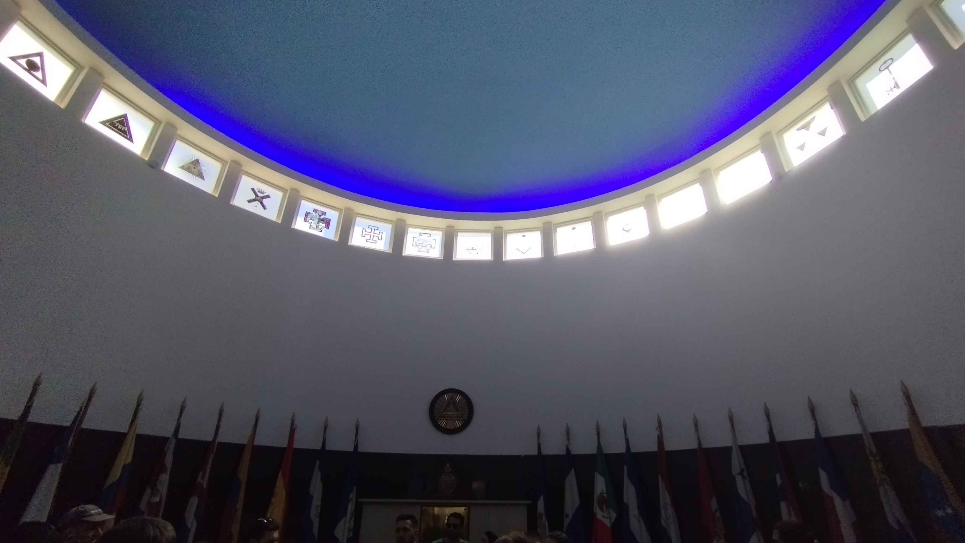
Español: El Palacio Masónico es la sede de la “Gran Logia de la Masonería del Uruguay”, y la "Rotonda de acceso" es una de las zonas más emblemáticas. A través de diversos símbolos se puede realizar un viaje donde se refleja historia, arte y tradiciones masónicas. Se pueden ver 33 ventanas que representan los grados del Rito Escocés Antiguo y Aceptado, y se constata una particular acústica como fenómeno físico: los sonidos emitidos en cualquier punto reverberan y se transmiten a lo largo de su circunferencia e impiden que pueda hablarse en secreto en ese sitio. Este edificio fue remodelado por el arquitecto masón Julio Vilamajó que fue declarado Patrimonio Histórico Nacional el 13 de febrero de 2020. |
| Date | |
| Source | Own work |
| Author | BiblioJu |
| Camera location | | View this and other nearby images on: OpenStreetMap |
|---|
.jpg¶ms=-34.900294_N_-056.165728_E_globe:Earth_type:camera__&language=en)
Licensing
edit.jpg&action=edit§ion=2)
I, the copyright holder of this work, hereby publish it under the following license:
This file is licensed under the Creative Commons Attribution-Share Alike 4.0 International license.
- You are free:
- to share – to copy, distribute and transmit the work
- to remix – to adapt the work
- Under the following conditions:
- attribution – You must give appropriate credit, provide a link to the license, and indicate if changes were made. You may do so in any reasonable manner, but not in any way that suggests the licensor endorses you or your use.
- share alike – If you remix, transform, or build upon the material, you must distribute your contributions under the same or compatible license as the original.
File history
Click on a date/time to view the file as it appeared at that time.
| Date/Time | Thumbnail | Dimensions | User | Comment | |
|---|---|---|---|---|---|
| current | 20:26, 8 October 2023 | | 3,264 × 1,836 (1.12 MB) | BiblioJu (talk | contribs) | Uploaded own work with UploadWizard |
You cannot overwrite this file.
File usage on Commons
There are no pages that use this file.
File usage on other wikis
The following other wikis use this file:
- Usage on es.wikipedia.org
.jpg&oldid=810445374)