File:Grand Erg Occidental and Grand Erg Oriental (MODIS 2019-06-28).jpg

Size of this preview: 755 × 599 pixels. Other resolutions: 302 × 240 pixels | 605 × 480 pixels | 968 × 768 pixels | 1,280 × 1,016 pixels | 2,560 × 2,032 pixels | 6,107 × 4,848 pixels.
Original file (6,107 × 4,848 pixels, file size: 2.3 MB, MIME type: image/jpeg)
Captions
Captions
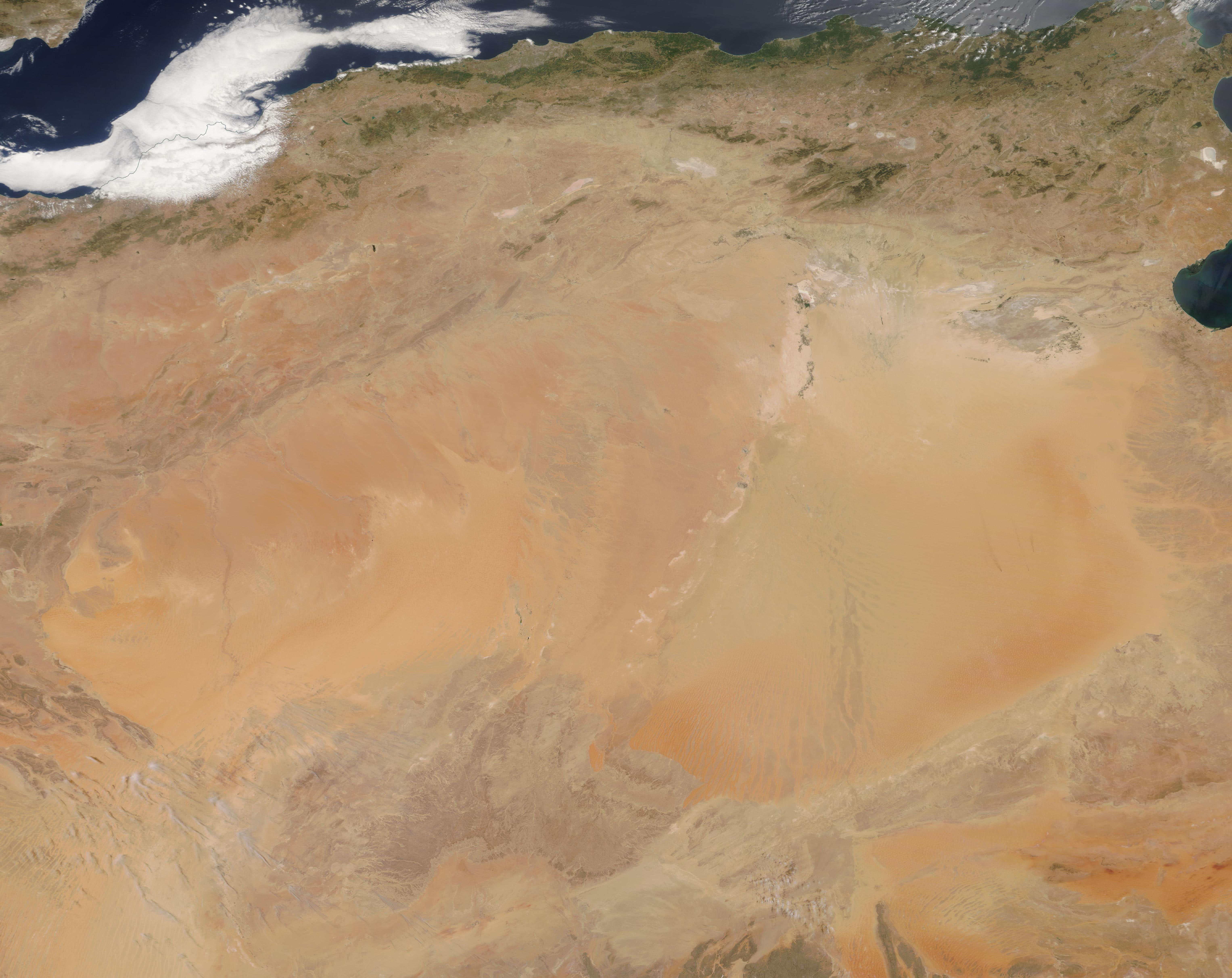
On June 23, 2019, the Moderate Resolution Imaging Spectroradiometer (MODIS) on board NASA’s Terra satellite acquired a stunning true-color image of two large fields of sand dunes, the Grand Erg Oriental and Grand Erg Occidental.
Summary edit
.jpg&action=edit§ion=1)
| Description |
English: The Sahara Desert covers nearly a third of the African Continent, spanning 3.6 million square miles (9.4 million sq. km) of northern Africa. It is the largest hot desert in the world, and ranks as the third largest desert on Earth following two vast cold deserts—Antarctica and the Arctic. The Sahara contains a variety of geographical features, such as plateaus, plains, and salt flats, but the most iconic features have to be vast seas of sand and dunes which sweep across various sections of the desert.
On June 23, 2019, the Moderate Resolution Imaging Spectroradiometer (MODIS) on board NASA’s Terra satellite acquired a stunning true-color image of two large fields of sand dunes, the Grand Erg Oriental and Grand Erg Occidental. These are located in northwestern Africa, primarily in Algeria. Large dune fields are known to geologists as “ergs,” the Arabic term for these extensive regions of sand; they are also sometimes called “sand seas”. The eastern erg is known as the Oriental. The western erg, the Occidental, is the smaller of the two. Each contain hundreds of sand dunes formed by prevailing winds. In some areas, large crescent-shaped dunes are mobile, moving as much as 65 to 100 feet in one year. |
||
| Date | Taken on 23 June 2019 | ||
| Source |
Grand Erg Occidental and Grand Erg Oriental (direct link)
|
||
| Author | MODIS Land Rapid Response Team, NASA GSFC |
| This media is a product of the Terra mission Credit and attribution belongs to the mission team, if not already specified in the "author" row |
Licensing edit
.jpg&action=edit§ion=2)
| This file is in the public domain in the United States because it was solely created by NASA. NASA copyright policy states that "NASA material is not protected by copyright unless noted". (See Template:PD-USGov, NASA copyright policy page or JPL Image Use Policy.) | ||
 |
Warnings:
|
File history
Click on a date/time to view the file as it appeared at that time.
| Date/Time | Thumbnail | Dimensions | User | Comment | |
|---|---|---|---|---|---|
| current | 03:14, 17 February 2024 | | 6,107 × 4,848 (2.3 MB) | OptimusPrimeBot (talk | contribs) | #Spacemedia - Upload of http://modis.gsfc.nasa.gov/gallery/images/image06282019_250m.jpg via Commons:Spacemedia |
You cannot overwrite this file.
File usage on Commons
There are no pages that use this file.
.jpg&oldid=852747305)