File:Grand Teton Park Boundaries in 1972.pdf

Size of this JPG preview of this PDF file: 463 × 599 pixels. Other resolutions: 185 × 240 pixels | 371 × 480 pixels | 593 × 768 pixels | 1,275 × 1,650 pixels.
Original file (1,275 × 1,650 pixels, file size: 1.21 MB, MIME type: application/pdf)
Captions
Captions
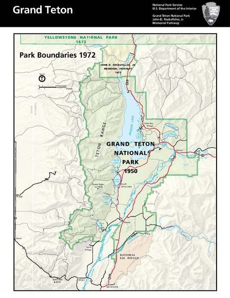
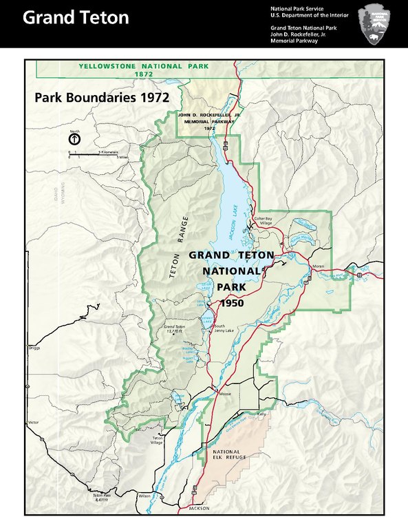
This map shows the most up-to-date boundaries of the Grand Teton National Park.
Summary edit
| Description |
English: The map shows the final and total area of the park with the added memorial highway that connects the northern section of the Teton National Park to the southern edge of Yellowstone along the North Park Road 89. |
| Date | |
| Source | https://www.nps.gov/grte/learn/historyculture/cultural.htm |
| Author | National Park Service |
Licensing edit
This work is in the public domain in the United States because it is a work prepared by an officer or employee of the United States Government as part of that person’s official duties under the terms of Title 17, Chapter 1, Section 105 of the US Code.
Note: This only applies to original works of the Federal Government and not to the work of any individual U.S. state, territory, commonwealth, county, municipality, or any other subdivision. This template also does not apply to postage stamp designs published by the United States Postal Service since 1978. (See § 313.6(C)(1) of Compendium of U.S. Copyright Office Practices). It also does not apply to certain US coins; see The US Mint Terms of Use.
|
 | |
| This file has been identified as being free of known restrictions under copyright law, including all related and neighboring rights. | ||
File history
Click on a date/time to view the file as it appeared at that time.
| Date/Time | Thumbnail | Dimensions | User | Comment | |
|---|---|---|---|---|---|
| current | 18:14, 10 June 2021 | 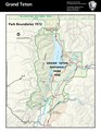 | 1,275 × 1,650 (1.21 MB) | UwyoAHC (talk | contribs) | Uploaded a work by National Park Service from https://www.nps.gov/grte/learn/historyculture/cultural.htm with UploadWizard |
You cannot overwrite this file.
File usage on Commons
The following 2 pages use this file:
File usage on other wikis
The following other wikis use this file:
- Usage on en.wikipedia.org