File:Grande seca de 2014, Ponte do Rio Mogi Guaçu na divisa dos municípios de Rincão e Guatapará. O Rio Mogi Guaçu estava com o fundo do rio visível e com várias ilhas no seu leito. Infelizmente, o - panoramio.jpg
Size of this preview: 800 × 600 pixels. Other resolutions: 320 × 240 pixels | 640 × 480 pixels | 1,024 × 768 pixels | 1,280 × 960 pixels | 2,560 × 1,920 pixels | 4,608 × 3,456 pixels.
Original file (4,608 × 3,456 pixels, file size: 5.28 MB, MIME type: image/jpeg)
Captions
Captions
Add a one-line explanation of what this file represents
Summary
edit
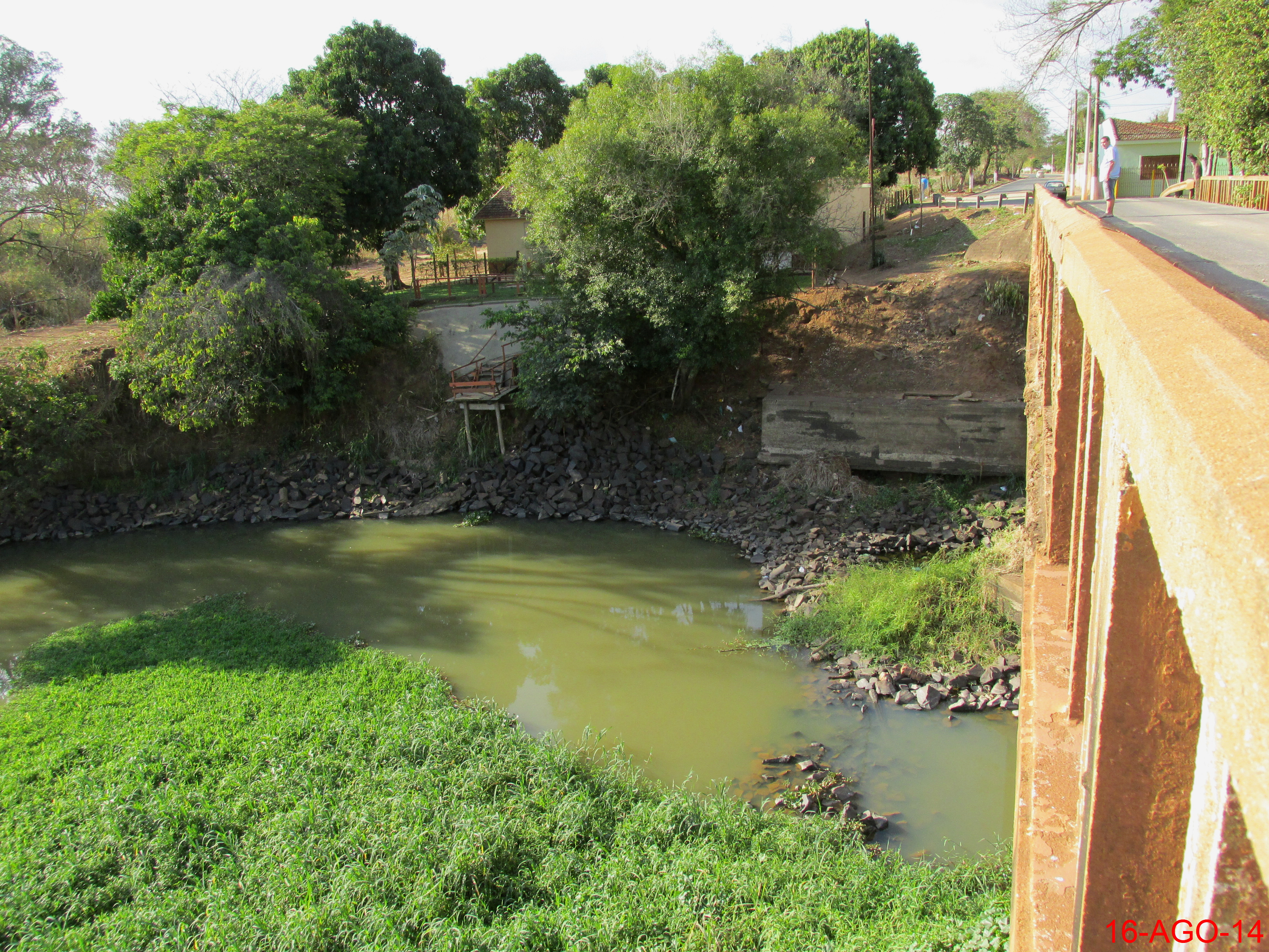
| Description | Grande seca de 2014, Ponte do Rio Mogi Guaçu na divisa dos municípios de Rincão e Guatapará. O Rio Mogi Guaçu estava com o fundo do rio visível e com várias ilhas no seu leito. Infelizmente, o Rio Mogi Guaçu nesta época do ano já estava com menos de 1 metro de profundidade. Os pilares de estrutura da ponte ficaram visíveis. Observe o nível de onde a água chegava em época de cheia. | ||
| Date | Taken on 16 August 2014 | ||
| Source | https://web.archive.org/web/20161102041933/http://www.panoramio.com/photo/114606571 | ||
| Author | MARCO AURÉLIO ESPARZ… | ||
| Permission (Reusing this file) |
This file is licensed under the Creative Commons Attribution-Share Alike 3.0 Unported license. Attribution: MARCO AURÉLIO ESPARZ…
|
||
| Panoramio Tags | Guatapará, best, Brasil, Brazil, Guatapará, Ponte, Rincão, Rio Mogi Guaçu, Seca |
| Camera location | | View this and other nearby images on: OpenStreetMap |
|---|
File history
Click on a date/time to view the file as it appeared at that time.
| Date/Time | Thumbnail | Dimensions | User | Comment | |
|---|---|---|---|---|---|
| current | 23:00, 10 May 2017 | | 4,608 × 3,456 (5.28 MB) | Panoramio upload bot (talk | contribs) | == {{int:filedesc}} == {{Information |description=Grande seca de 2014, Ponte do Rio Mogi Guaçu na divisa dos municípios de Rincão e Guatapará. O Rio Mogi Guaçu estava com o fundo do rio visível e com várias ilhas no seu leito. Infelizmente, o Ri... |
You cannot overwrite this file.
File usage on Commons
There are no pages that use this file.