File:Granite Mountains, Mojave National Preserve, California (15036225683).jpg

Original file (4,000 × 2,480 pixels, file size: 1.86 MB, MIME type: image/jpeg)
Captions
Captions
Summary edit
.jpg&action=edit§ion=1)
| Description |
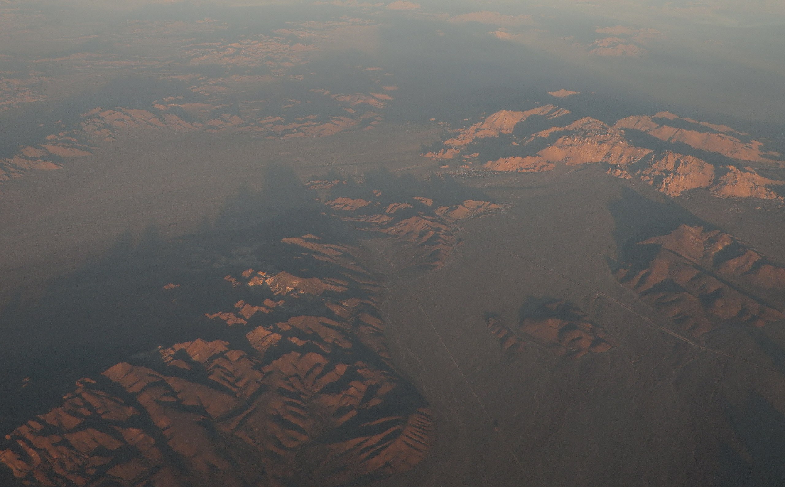
The Granite Mountains is a small mountain range in San Bernardino County, California, USA, located in the Mojave Desert. They are in the Mojave National Preserve, in the National Park Service system. Some of the more striking rock formations in the Mojave National Preserve lie in the Granite Mountains. These granitic rocks have eroded into unusual rounded shapes that include spires, perched boulders, and curved cliff faces. Granitic rocks represent the roots of ancient continental-margin volcanic systems. Most of the granitic rock in the Mojave Desert is late Mesozoic in age (80 to 180 million years old). The granites formed at depth within a volcanically active mountain range comparable in geologic setting to the Andes chain in South America. The granitoids formed by the slow cooling and solidification of molten magma bodies that developed above sinking slabs of oceanic crust overridden by the edge of the continent. At least 55 or 60 million years elapsed between the crystallization of the last Mesozoic magma bodies and deposition of the youngest-preserved overlying strata. Several springs exist in the Granite Mountains, though they may not flow year round. en.wikipedia.org/wiki/Granite_Mountains_(California) en.wikipedia.org/wiki/Wikipedia:Text_of_Creative_Commons_... |
| Date | |
| Source | Granite Mountains, Mojave National Preserve, California |
| Author | Ken Lund from Reno, Nevada, USA |
| Camera location | | View this and other nearby images on: OpenStreetMap |
|---|
.jpg¶ms=034.617738_N_-115.409337_E_globe:Earth_type:camera_source:Flickr_&language=en)
Licensing edit
.jpg&action=edit§ion=2)
- You are free:
- to share – to copy, distribute and transmit the work
- to remix – to adapt the work
- Under the following conditions:
- attribution – You must give appropriate credit, provide a link to the license, and indicate if changes were made. You may do so in any reasonable manner, but not in any way that suggests the licensor endorses you or your use.
- share alike – If you remix, transform, or build upon the material, you must distribute your contributions under the same or compatible license as the original.
| This image was originally posted to Flickr by Ken Lund at https://flickr.com/photos/75683070@N00/15036225683. It was reviewed on 4 December 2015 by FlickreviewR and was confirmed to be licensed under the terms of the cc-by-sa-2.0. |
File history
Click on a date/time to view the file as it appeared at that time.
| Date/Time | Thumbnail | Dimensions | User | Comment | |
|---|---|---|---|---|---|
| current | 19:37, 27 December 2015 | | 4,000 × 2,480 (1.86 MB) | INeverCry (talk | contribs) | Cropped 17 % vertically using CropTool with lossless mode. |
| 04:01, 4 December 2015 |  | 4,000 × 3,000 (2.32 MB) | INeverCry (talk | contribs) | Transferred from Flickr via Flickr2Commons |
You cannot overwrite this file.
File usage on Commons
The following page uses this file:
.jpg&oldid=503637755)