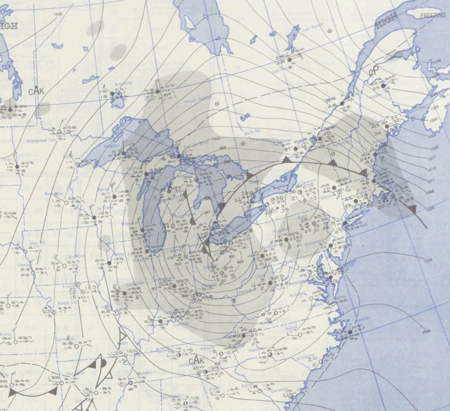
File:Great Appalachian Storm 1950-11-26 weather map.gif

Size of this preview: 657 × 600 pixels. Other resolutions: 263 × 240 pixels | 526 × 480 pixels | 1,000 × 913 pixels.
Original file (1,000 × 913 pixels, file size: 609 KB, MIME type: image/gif)
Captions
Captions
Add a one-line explanation of what this file represents
Summary
| Description | ||||
| Date | ||||
| Source | NOAA Central Library Data Imaging Project | |||
| Author | NOAA Central Library, Silver Spring, Maryland | |||
| Permission (Reusing this file) |
|
File history
Click on a date/time to view the file as it appeared at that time.
| Date/Time | Thumbnail | Dimensions | User | Comment | |
|---|---|---|---|---|---|
| current | 01:44, 10 November 2009 | | 1,000 × 913 (609 KB) | Rockfang (talk | contribs) | == Summary == Daily Weather Maps U. S. Weather Bureau http://docs.lib.noaa.gov/rescue/dwm/1950/19501126.djvu == Licensing == {{PD-USGov-NOAA}} == Original upload history == This file was originally uploaded at en.wikipedia as [http://en.wikipedia.org/wi |
You cannot overwrite this file.
File usage on Commons
The following 2 pages use this file:
- File:19501126sfc.gif (file redirect)
- File:1950 Events montage 16-grid version.jpg
File usage on other wikis
The following other wikis use this file:
- Usage on en.wikipedia.org
- Usage on ru.wikipedia.org