File:Great Britain army 512 Field Survey Company, El Arish (FL155883057 4073102).jpg

Size of this preview: 784 × 600 pixels. Other resolutions: 314 × 240 pixels | 627 × 480 pixels | 1,004 × 768 pixels | 1,280 × 979 pixels | 2,560 × 1,959 pixels | 16,746 × 12,814 pixels.
Original file (16,746 × 12,814 pixels, file size: 219.67 MB, MIME type: image/jpeg)
Captions
Captions
Add a one-line explanation of what this file represents
Summary
edit| El Arish
( |
||||||||||||||||||||||||
|---|---|---|---|---|---|---|---|---|---|---|---|---|---|---|---|---|---|---|---|---|---|---|---|---|
| Artist |
|
|||||||||||||||||||||||
| Title |
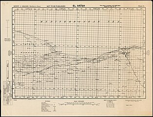
El Arish |
|||||||||||||||||||||||
| Publisher |
Survey of Egypt |
|||||||||||||||||||||||
| Description |
El Arish. Reproduced by 512 (A.Fd.Svy). Coy. R.E. from a Survey of Egypt map. |
|||||||||||||||||||||||
| Language | English | |||||||||||||||||||||||
| Publication date | 1941 | |||||||||||||||||||||||
| Medium | 1 sheet ; | |||||||||||||||||||||||
| Dimensions | height: 51 cm (20 in); width: 71 cm (27.9 in) | |||||||||||||||||||||||
| Collection |
|
|||||||||||||||||||||||
| Current location |
|
|||||||||||||||||||||||
| Place of publication | unknown | |||||||||||||||||||||||
| search Merhav catalog | unknown | |||||||||||||||||||||||
| Notes |
English: Egypt 1:100,000, Northern Sinai ; 2 | |||||||||||||||||||||||
| scale | 1:100,000 cm | |||||||||||||||||||||||
| IE PID | IE155883055 | |||||||||||||||||||||||
| Rosetta filename | FL155883057 | |||||||||||||||||||||||
| NNL item ID (P3959) | 990040731020205171 | |||||||||||||||||||||||
| search Merhav catalog | English, Great Britain army 512 Field Survey Company | |||||||||||||||||||||||
| search Merhav catalog | Survey of Egypt | |||||||||||||||||||||||
| Source/Photographer |
|
|||||||||||||||||||||||
| Other versions | ||||||||||||||||||||||||
| Jpg / Tif version |
|
|||||||||||||||||||||||

.jpg)

.jpg&action=edit§ion=1)
Licensing
edit.jpg&action=edit§ion=2)
This work created by the United Kingdom Government is in the public domain.
This is because it is one of the following:
HMSO has declared that the expiry of Crown Copyrights applies worldwide (ref: HMSO Email Reply)
|
 |
File history
Click on a date/time to view the file as it appeared at that time.
| Date/Time | Thumbnail | Dimensions | User | Comment | |
|---|---|---|---|---|---|
| current | 02:45, 11 August 2023 | | 16,746 × 12,814 (219.67 MB) | Geagea (talk | contribs) | pattypan 22.03 |
You cannot overwrite this file.
File usage on Commons
The following page uses this file:
.jpg&oldid=792570128)