File:Greece, Turkey, and the Aegean Sea (MODIS 2016-04-22).jpg

Size of this preview: 798 × 600 pixels. Other resolutions: 320 × 240 pixels | 639 × 480 pixels | 1,022 × 768 pixels | 1,280 × 962 pixels | 1,930 × 1,450 pixels.
Original file (1,930 × 1,450 pixels, file size: 204 KB, MIME type: image/jpeg)
Captions
Captions
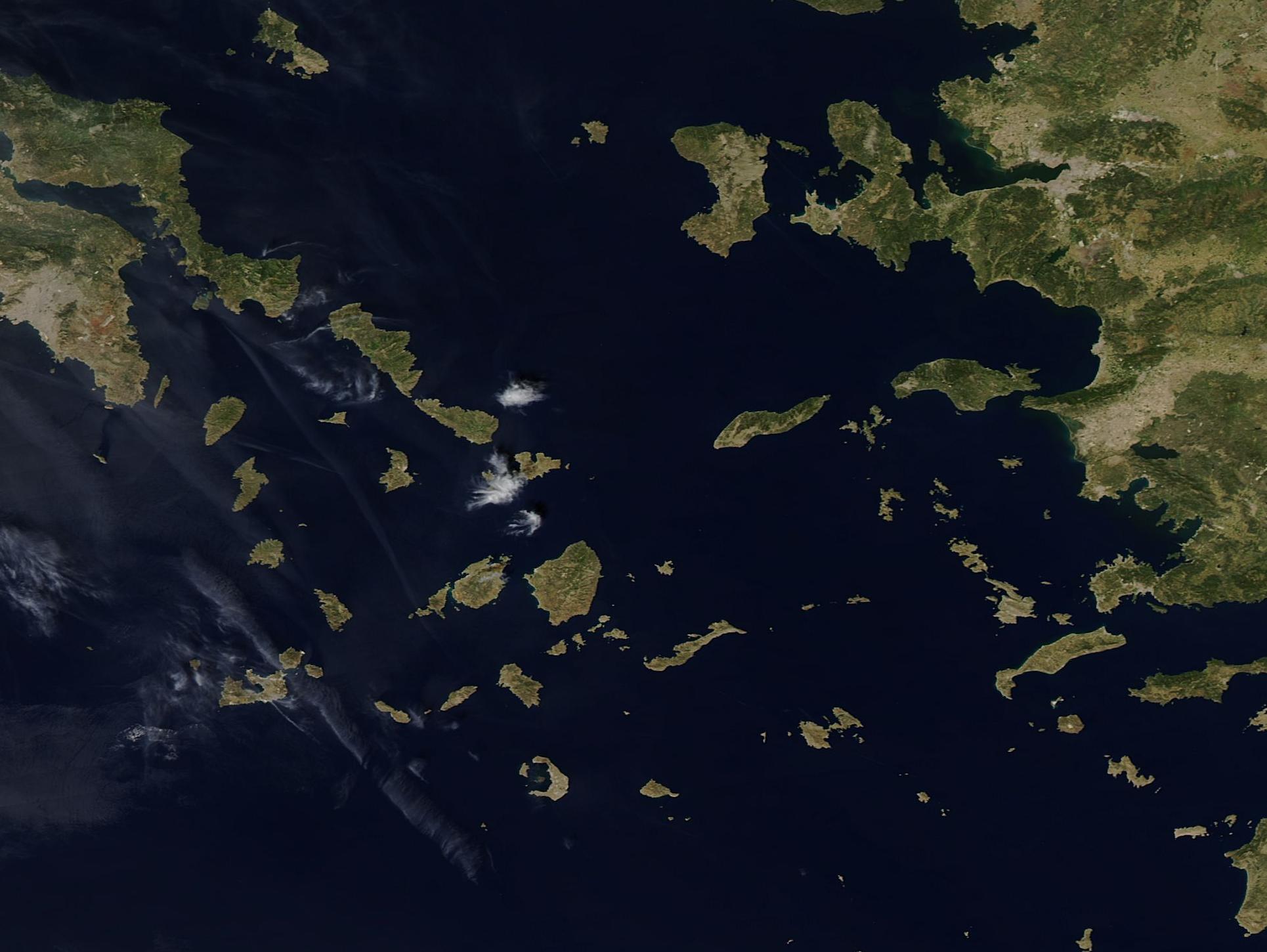
On April 17, 2016, the Moderate Resolution Imaging Spectroradiometer (MODIS) aboard NASA's Aqua satellite passed over the Aegean Sea and captured a true-color image of the region.
Summary
edit.jpg&action=edit§ion=1)
| Description |
English: The Aegean Sea is a unique saltwater sea that is bounded by Turkey on the east and by Greece on the north and west. An arc of Greek islands (Rhodes, Crete, and Kythera) define the southern boundary of the Aegean. The Aegean is one of the four major basins of the eastern Mediterranean Sea, and it is unique in that more than 3,000 islands are scattered across the approximately 240,000 sq. km. (92,664 sq. mi) area.
On April 17, 2016, the Moderate Resolution Imaging Spectroradiometer (MODIS) aboard NASA's Aqua satellite passed over the Aegean Sea and captured a true-color image of the region. Near the edge of the west (left) side of the image, a group of gray pixels can be seen. This large smudge is the city of Athens, home to approximately 655,000 people. Athens is the largest city in Greece as well as the capital of the country. Turkey lies on the east side of the Aegean. Most of the islands captured in this image belong to the Cyclades group, so named because they encircle the tiny, sacred island of Delos. Delos is thought to have been inhabited as early as the 3rd millennium B.C., and one of its multiple mystic and holy claims was its reputation as the birthplace of the twin gods, Apollo and Artemis. |
||
| Date | Taken on 17 April 2016 | ||
| Source |
Greece, Turkey, and the Aegean Sea (direct link)
|
||
| Author | Jeff Schmaltz, MODIS Land Rapid Response Team, NASA GSFC |
| This media is a product of the Aqua mission Credit and attribution belongs to the mission team, if not already specified in the "author" row |
Licensing
edit.jpg&action=edit§ion=2)
| This file is in the public domain in the United States because it was solely created by NASA. NASA copyright policy states that "NASA material is not protected by copyright unless noted". (See Template:PD-USGov, NASA copyright policy page or JPL Image Use Policy.) | ||
 |
Warnings:
|
File history
Click on a date/time to view the file as it appeared at that time.
| Date/Time | Thumbnail | Dimensions | User | Comment | |
|---|---|---|---|---|---|
| current | 19:37, 15 February 2024 | | 1,930 × 1,450 (204 KB) | OptimusPrimeBot (talk | contribs) | #Spacemedia - Upload of http://modis.gsfc.nasa.gov/gallery/images/image04222016_250m.jpg via Commons:Spacemedia |
You cannot overwrite this file.
File usage on Commons
There are no pages that use this file.
.jpg&oldid=852072455)