File:Greece (MODIS 2019-05-25).jpg

Original file (2,585 × 1,891 pixels, file size: 1.2 MB, MIME type: image/jpeg)
Captions
Captions
Summary edit
.jpg&action=edit§ion=1)
| Description |
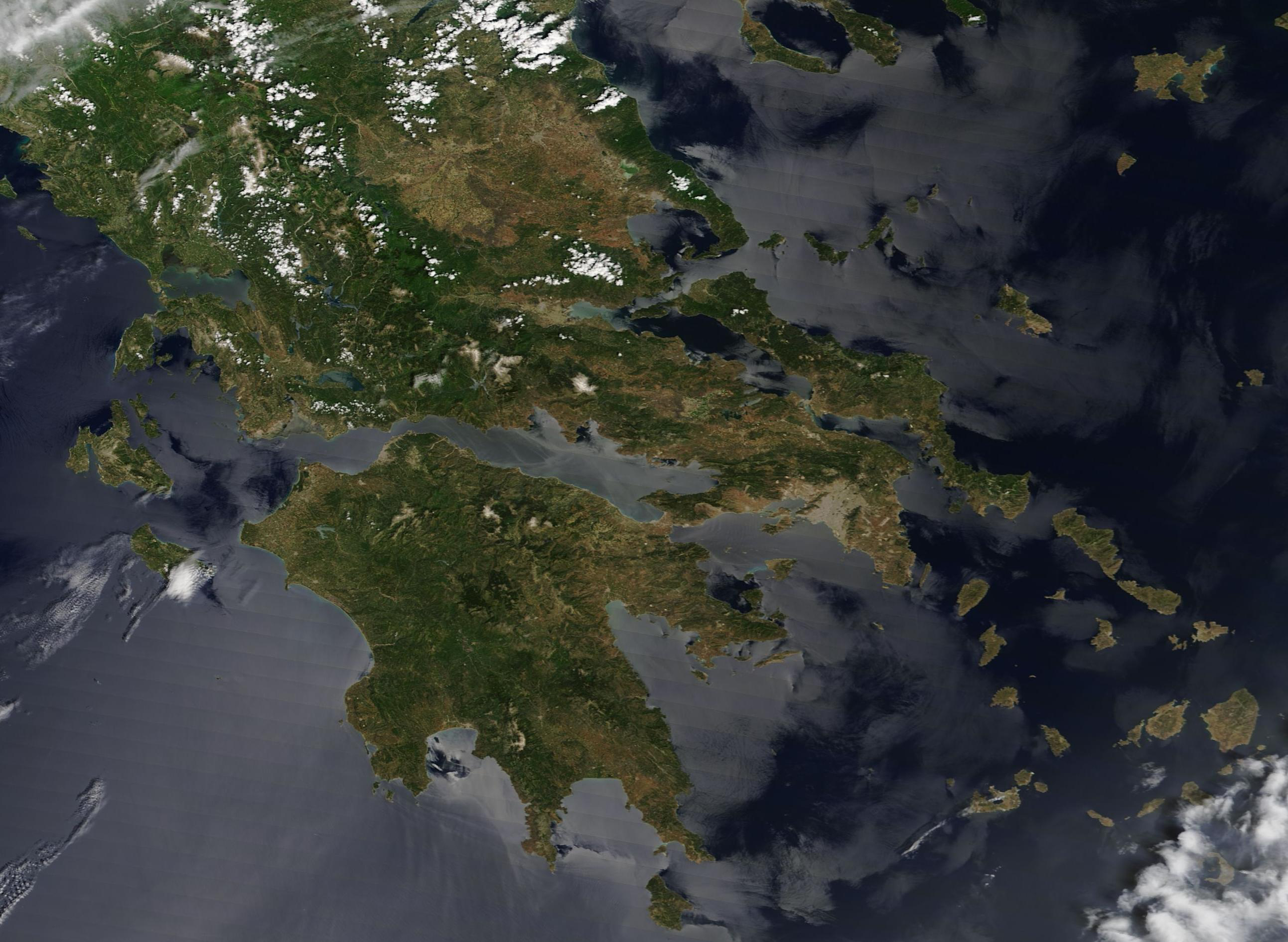
English: The skies were clear over Greece on May 23, 2019 when NASA’s Aqua satellite passed overhead. The Moderate Resolution Spectroradiometer (MODIS) on board that satellite acquired a true-color image of Greece surrounded by sunglint on that same day.
Greece sits at the southern tip of the Balkan Peninsula in Southern Europe. The mountainous mainland ends at the Peloponnese peninsula, a rugged, island-like landmass encompassing 8,278 square miles (21,439 square km) which juts into the Mediterranean Sea. The Peloponnese peninsula is attached to the mainland by the Isthmus of Corinth. An additional array of about 6,000 Greek islands and islets scatter the Aegean and Ionian Seas, of which only 227 are inhabited. In this image, popcorn clouds cover the tops of many of the country’s mountains, especially on the mainland while several valleys appear tan. Gray pixels mark cities, with Athens, the largest city and capital, located at the tip of the mainland on the Saronic Gulf facing the Peloponnese peninsula. The mirror-like silver tint to the waters surrounding Greece is due to sunglint. This is an optical phenomenon that occurs when sunlight reflects off the surface of water at the same angle that a satellite sensor views it. The result is a mirror-like specular reflection of sunlight off the water and back at the satellite sensor. Areas where the water is turbid or which are not in the region of sunglint appear blue. |
||
| Date | Taken on 23 May 2019 | ||
| Source |
|
||
| Author | MODIS Land Rapid Response Team, NASA GSFC |
| This media is a product of the Aqua mission Credit and attribution belongs to the mission team, if not already specified in the "author" row |
Licensing edit
.jpg&action=edit§ion=2)
| This file is in the public domain in the United States because it was solely created by NASA. NASA copyright policy states that "NASA material is not protected by copyright unless noted". (See Template:PD-USGov, NASA copyright policy page or JPL Image Use Policy.) | ||
 |
Warnings:
|
File history
Click on a date/time to view the file as it appeared at that time.
| Date/Time | Thumbnail | Dimensions | User | Comment | |
|---|---|---|---|---|---|
| current | 03:19, 17 February 2024 | | 2,585 × 1,891 (1.2 MB) | OptimusPrimeBot (talk | contribs) | #Spacemedia - Upload of http://modis.gsfc.nasa.gov/gallery/images/image05252019_250m.jpg via Commons:Spacemedia |
You cannot overwrite this file.
File usage on Commons
There are no pages that use this file.
.jpg&oldid=852747561)