File:Greenland-municipalities-2018 mk.svg

Size of this PNG preview of this SVG file: 300 × 500 pixels. Other resolutions: 144 × 240 pixels | 288 × 480 pixels | 461 × 768 pixels | 614 × 1,024 pixels | 1,229 × 2,048 pixels.
Original file (SVG file, nominally 300 × 500 pixels, file size: 24 KB)
Captions
Captions
Add a one-line explanation of what this file represents
Summary edit
| Description |
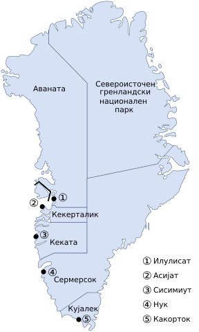
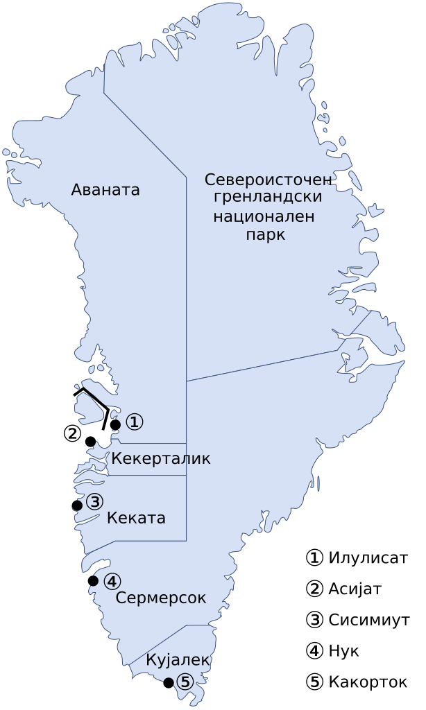
Македонски: Карта на административната поделба на Гренланд од 1 јануари 2018 на македонски. English: Administrative divisions of Greenland since 2018/01/01, with municipal centers marked with numbers in Macedonian. |
| Date | |
| Source | |
| Author |
|
| Other versions | English version |
I, the copyright holder of this work, hereby publish it under the following license:
| I, the copyright holder of this work, release this work into the public domain. This applies worldwide. In some countries this may not be legally possible; if so: I grant anyone the right to use this work for any purpose, without any conditions, unless such conditions are required by law. |
File history
Click on a date/time to view the file as it appeared at that time.
| Date/Time | Thumbnail | Dimensions | User | Comment | |
|---|---|---|---|---|---|
| current | 10:15, 1 August 2018 | | 300 × 500 (24 KB) | MacedonianBoy (talk | contribs) | User created page with UploadWizard |
You cannot overwrite this file.
File usage on Commons
There are no pages that use this file.
File usage on other wikis
The following other wikis use this file:
- Usage on mk.wikipedia.org