File:Groningen trams 2009.png
Size of this preview: 670 × 600 pixels. Other resolutions: 268 × 240 pixels | 536 × 480 pixels | 858 × 768 pixels | 1,144 × 1,024 pixels | 2,288 × 2,048 pixels | 3,207 × 2,871 pixels.
Original file (3,207 × 2,871 pixels, file size: 15.54 MB, MIME type: image/png)
Captions
Captions
Add a one-line explanation of what this file represents
| Description |
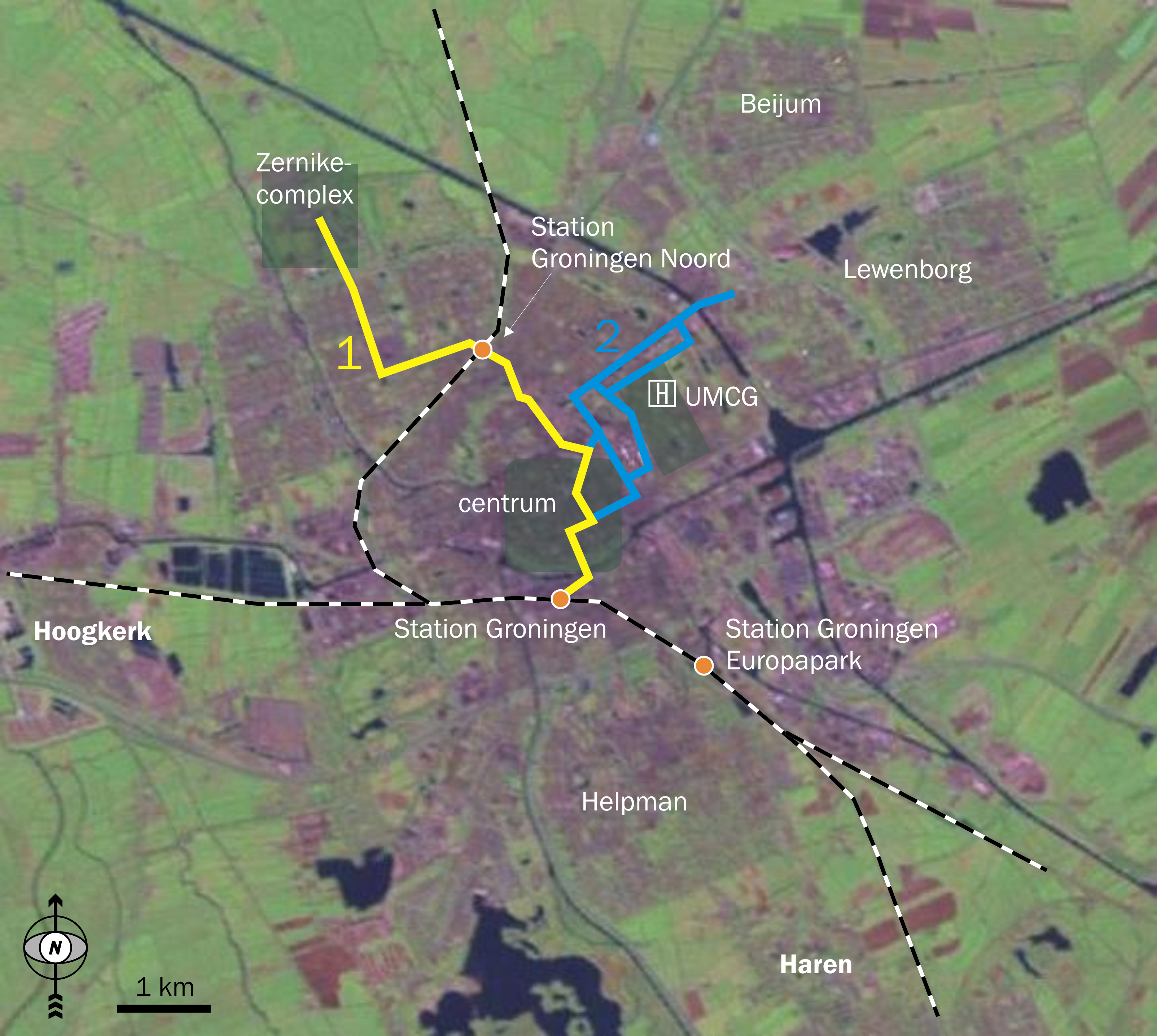
Screenshot from NASA World Wind. Zoom of the town Groningen. Map shows tram line 1 (route decided upon early 2009) and tram line 2 (route to be decided upon in 2010). Also uses . . |
| Date | (UTC) |
| Source | |
| Author |
|
| This image is in the public domain because it is a screenshot from NASA’s globe software World Wind using a public domain layer, such as Blue Marble, MODIS, Landsat, SRTM, USGS or GLOBE.
|
 |
Original upload log
edit
This image is a derivative work of the following images:
- File:Groningen_6.56053E_53.21538N-zoom.jpg licensed with PD-WorldWind
- 2005-06-16T16:32:58Z Jeroencommons 591x529 (47768 Bytes) Screenshot from NASA [[World Wind]]. Zoom of the town Groningen. {{PD-USGov-NASA}} [[Category:Maps of the Netherlands]]
Uploaded with derivativeFX
File history
Click on a date/time to view the file as it appeared at that time.
| Date/Time | Thumbnail | Dimensions | User | Comment | |
|---|---|---|---|---|---|
| current | 20:29, 4 October 2009 | | 3,207 × 2,871 (15.54 MB) | Classical geographer (talk | contribs) | {{Information |Description=Screenshot from NASA World Wind. Zoom of the town Groningen. Map shows tram line 1 (route decided upon early 2009) and tram line 2 (route to be decided upon in 2010). Also uses 50px. |Source=* |
You cannot overwrite this file.
File usage on Commons
The following page uses this file:
File usage on other wikis
The following other wikis use this file:
- Usage on nl.wikipedia.org
- Usage on www.wikidata.org