File:Groot Thurgau IMG 8910.jpg
Size of this preview: 448 × 600 pixels. Other resolutions: 179 × 240 pixels | 358 × 480 pixels | 574 × 768 pixels | 765 × 1,024 pixels | 1,936 × 2,592 pixels.
Original file (1,936 × 2,592 pixels, file size: 1.52 MB, MIME type: image/jpeg)
Captions
Captions
Add a one-line explanation of what this file represents
Summary
edit
| Description |
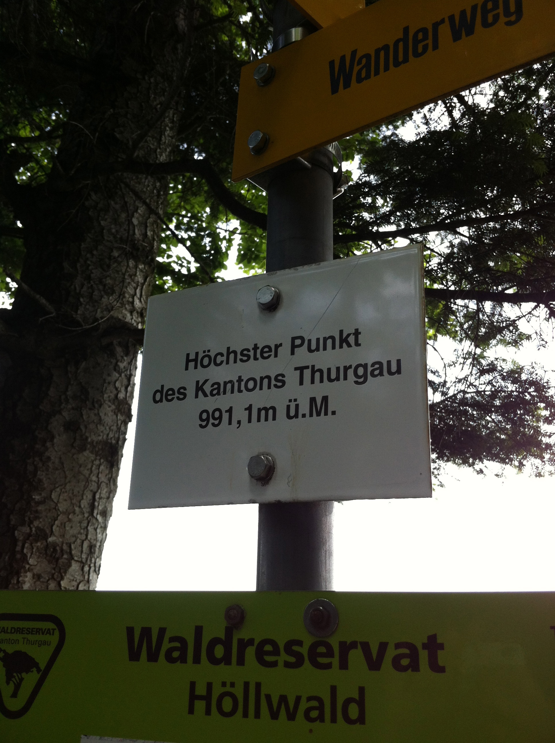
Deutsch: höchster Vermessungspunkt des Kantons Thurgau |
| Date | |
| Source | Vermessungstafel, kantonale Beschriftung |
| Author | geca001 |
| Remarks | Deutsch: Nicht das Hörnli ist der höchste Vermessungspunkt des Kantons Thurgau, sondern der "Grat", auch "Groot" genannt. |
Licensing
edit

|
The copyright holder of this work allows anyone to use it for any purpose including unrestricted redistribution, commercial use, and modification.
Usage notes:
|
Original upload log
edit
Transferred from de.wikipedia to Commons by Wdwdbot using script bot_filetrans.pl (r107:108M).
The original description page was here. All following user names refer to de.wikipedia.
- 2018-05-27 16:27:48 Geca001 (1598078 Bytes) {{Information |Beschreibung = höchster Vermessungspunkt des Kantons Thurgau |Quelle = Vermessungstafel, kantonale Beschriftung |Urheber = G.Capol |Datum = 27.05.2018 |Genehmigung = |Andere Versionen = |Anmerkungen = Nicht das Hörnli ist der höchste Vermessungspunkt des Kantons Thurgau, sondern der "Grat", auch "Groot" genannt. }}
File history
Click on a date/time to view the file as it appeared at that time.
| Date/Time | Thumbnail | Dimensions | User | Comment | |
|---|---|---|---|---|---|
| current | 08:28, 29 May 2018 | | 1,936 × 2,592 (1.52 MB) | Wdwdbot (talk | contribs) | Bot Move: Original uploader of this revision (#1) was Geca001 at de.wikipedia |
You cannot overwrite this file.
File usage on Commons
There are no pages that use this file.