File:Guadaloupe, one of the Caribee Islands in the West Indies from the latest discovery. LOC 74691487.jpg
Size of this preview: 755 × 600 pixels. Other resolutions: 302 × 240 pixels | 604 × 480 pixels | 967 × 768 pixels | 1,280 × 1,017 pixels | 2,560 × 2,034 pixels | 3,083 × 2,450 pixels.
Original file (3,083 × 2,450 pixels, file size: 1.21 MB, MIME type: image/jpeg)
Captions
Captions
Add a one-line explanation of what this file represents
Summary edit
| Description |
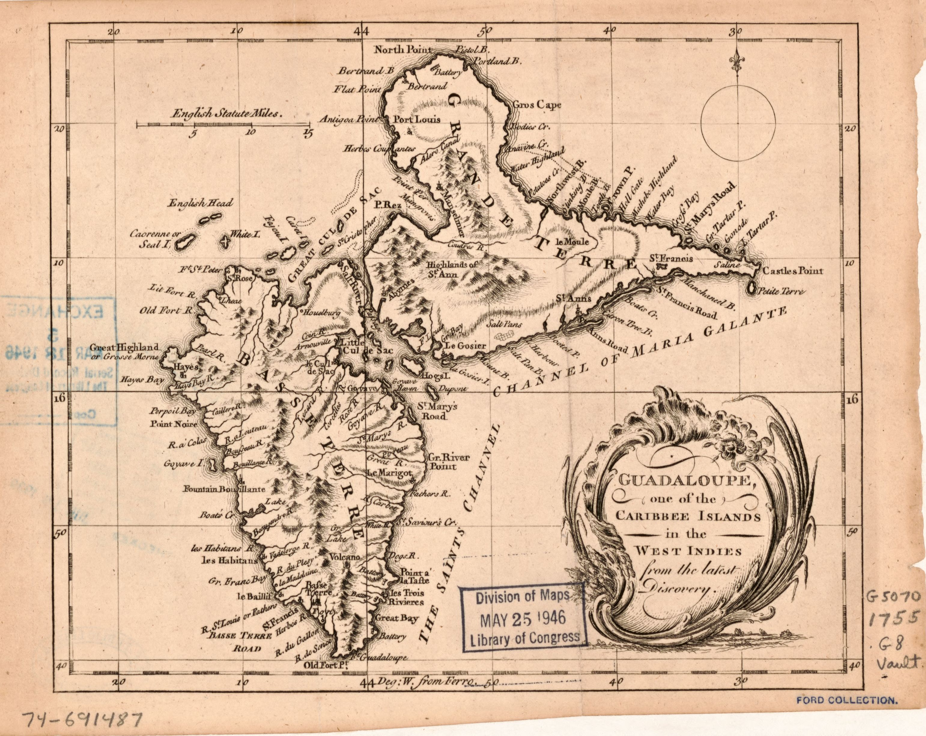
English: Scale ca. 1:500,000. Relief shown by hachures. Prime meridian: Ferro. Stamped on: Ford Collection. LC Maps of North America, 1750-1789, 2008 Available also through the Library of Congress Web site as a raster image. Vault AACR2 |
||
| Title | Guadaloupe, one of the Caribee Islands in the West Indies from the latest discovery. | ||
| Shelf ID | G5070 1755 .G8 | ||
| Date | |||
| Source | https://www.loc.gov/item/74691487/ | ||
| Author | Unknown author | ||
| Permission (Reusing this file) |
|
||
| Other versions |
|
||
| Location | Guadeloupe · Guadeloupe. | ||
| Part of | Military Battles And Campaigns · American Memory · Catalog · Geography And Map Division · American Revolution And Its Era: Maps And Charts Of North America And The West Indies, 1750-1789 | ||
| Subject | Maps · Early Works To 1800 · Guadeloupe |


Licensing edit
|
This is a faithful photographic reproduction of a two-dimensional, public domain work of art. The work of art itself is in the public domain for the following reason:
The official position taken by the Wikimedia Foundation is that "faithful reproductions of two-dimensional public domain works of art are public domain".
This photographic reproduction is therefore also considered to be in the public domain in the United States. In other jurisdictions, re-use of this content may be restricted; see Reuse of PD-Art photographs for details. | ||||
File history
Click on a date/time to view the file as it appeared at that time.
| Date/Time | Thumbnail | Dimensions | User | Comment | |
|---|---|---|---|---|---|
| current | 15:45, 14 May 2019 | | 3,083 × 2,450 (1.21 MB) | Fæ (talk | contribs) | LOC Maps https://www.loc.gov/item/74691487/ #6989 |
You cannot overwrite this file.
File usage on Commons
The following page uses this file: