File:GuamCensusBlockMap.pdf

Size of this JPG preview of this PDF file: 655 × 600 pixels. Other resolutions: 262 × 240 pixels | 524 × 480 pixels | 838 × 768 pixels | 1,118 × 1,024 pixels | 2,236 × 2,048 pixels | 5,404 × 4,950 pixels.
Original file (5,404 × 4,950 pixels, file size: 234 KB, MIME type: application/pdf)
Captions
Captions
Add a one-line explanation of what this file represents
Summary edit
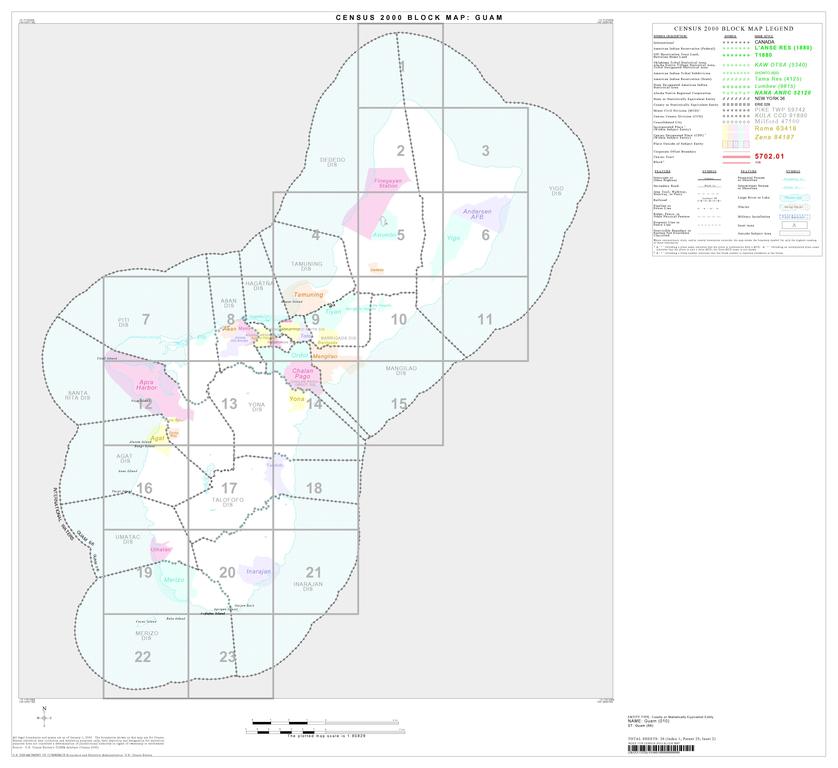
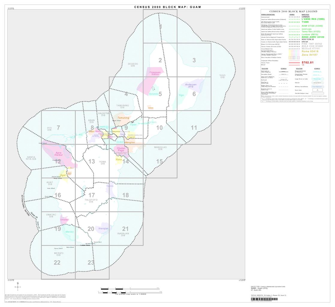
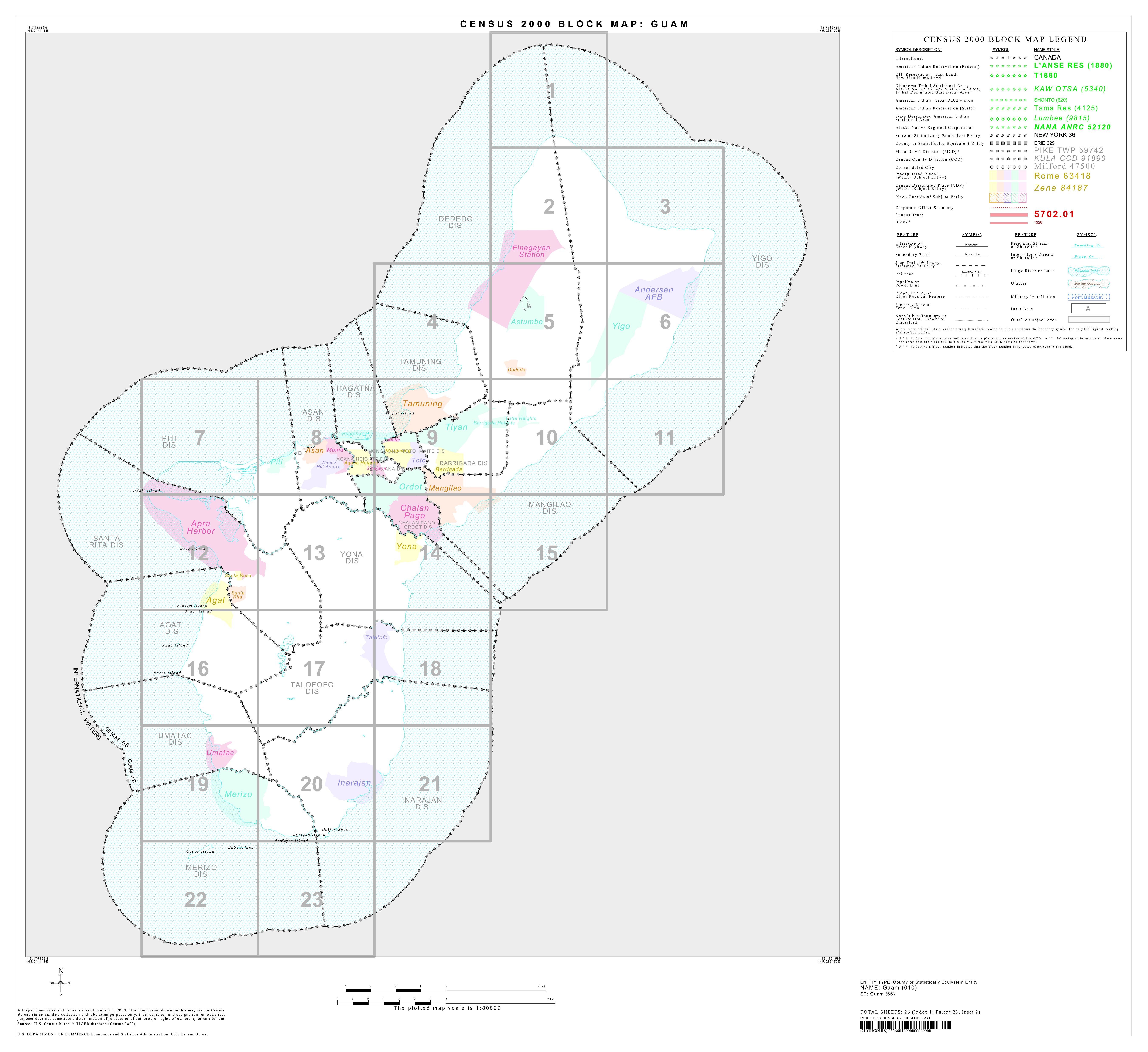
| Description |
English: U.S. Census Block Map of Guam |
|||
| Source | http://ftp2.census.gov/geo/maps/blk2000/st66_Guam/County/66010_Guam/CBC66010_000.pdf | |||
| Author | U.S. Census Bureau | |||
| Permission (Reusing this file) |
|
|||
| Other versions |

.jpg)

|
This map image could be re-created using vector graphics as an SVG file. This has several advantages; see Commons:Media for cleanup for more information. If an SVG form of this image is available, please upload it and afterwards replace this template with
{{vector version available|new image name}}.
It is recommended to name the SVG file “GuamCensusBlockMap.svg”—then the template Vector version available (or Vva) does not need the new image name parameter. |
File history
Click on a date/time to view the file as it appeared at that time.
| Date/Time | Thumbnail | Dimensions | User | Comment | |
|---|---|---|---|---|---|
| current | 21:02, 4 February 2009 |  | 5,404 × 4,950 (234 KB) | WhisperToMe (talk | contribs) | {{Information |Description={{en|1=U.S. Census Block Map of Guam}} |Source=http://ftp2.census.gov/geo/maps/blk2000/st66_Guam/County/66010_Guam/CBC66010_000.pdf |Author=U.S. Census Bureau |Date= |Permission=Public domain |other_versions= }} <!--{{ImageUplo |
You cannot overwrite this file.
File usage on Commons
The following page uses this file: