File:GuangximapRT.png
Size of this preview: 800 × 544 pixels. Other resolutions: 320 × 218 pixels | 640 × 435 pixels | 1,024 × 697 pixels | 1,280 × 871 pixels | 3,000 × 2,041 pixels.
Original file (3,000 × 2,041 pixels, file size: 470 KB, MIME type: image/png)
Captions
Captions
Add a one-line explanation of what this file represents
Summary
edit
| Description |
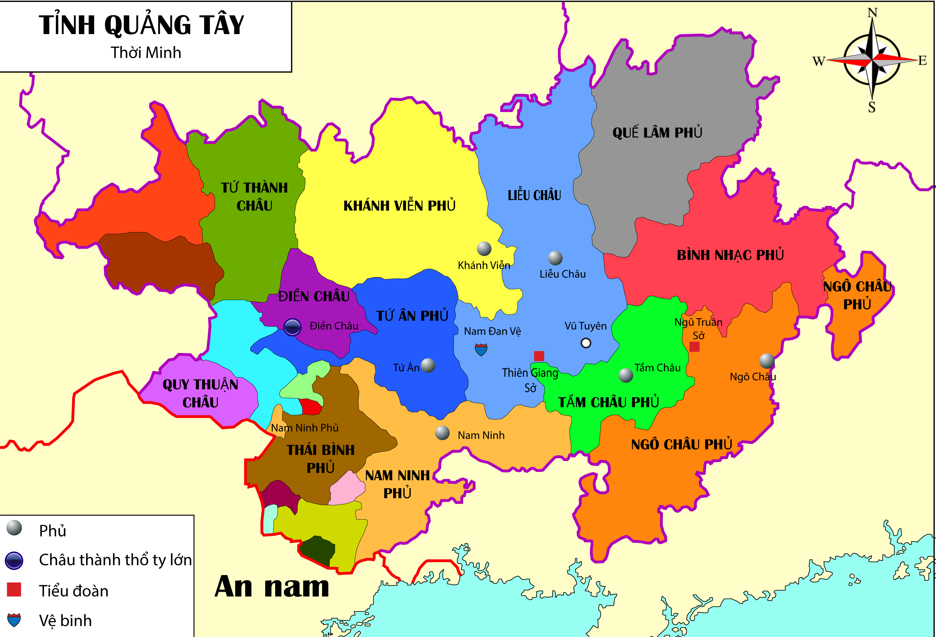
English: Map of Guangxi province in the early 16th century, based on George L. Israel's map. Sources: Doing Good and Ridding Evil in Ming China: The Political Career of Wang Yangming. BRILL (2014), p. 243. ISBN 9004280103. [1] and Guangxi province map during the Ming dynasty [2] (scroll down and click on Chinese characters 广西).
|
| Date | |
| Source | Own work |
| Author | Bookworm8899 |
Licensing
edit
I, the copyright holder of this work, hereby publish it under the following license:
This file is licensed under the Creative Commons Attribution-Share Alike 4.0 International license.
- You are free:
- to share – to copy, distribute and transmit the work
- to remix – to adapt the work
- Under the following conditions:
- attribution – You must give appropriate credit, provide a link to the license, and indicate if changes were made. You may do so in any reasonable manner, but not in any way that suggests the licensor endorses you or your use.
- share alike – If you remix, transform, or build upon the material, you must distribute your contributions under the same or compatible license as the original.
File history
Click on a date/time to view the file as it appeared at that time.
| Date/Time | Thumbnail | Dimensions | User | Comment | |
|---|---|---|---|---|---|
| current | 07:43, 3 November 2015 | | 3,000 × 2,041 (470 KB) | Bookworm8899 (talk | contribs) | Fixed |
| 06:54, 3 November 2015 |  | 3,000 × 2,041 (472 KB) | Bookworm8899 (talk | contribs) | User created page with UploadWizard |
You cannot overwrite this file.
File usage on Commons
There are no pages that use this file.
File usage on other wikis
The following other wikis use this file:
- Usage on vi.wikipedia.org