File:Guará 2017-12-09 1532Z.jpg

Size of this preview: 800 × 600 pixels. Other resolutions: 320 × 240 pixels | 640 × 480 pixels | 1,024 × 768 pixels | 1,280 × 960 pixels | 2,560 × 1,920 pixels | 5,600 × 4,200 pixels.
Original file (5,600 × 4,200 pixels, file size: 7.95 MB, MIME type: image/jpeg)
Captions
Captions
Add a one-line explanation of what this file represents
Summary
edit
| Description |
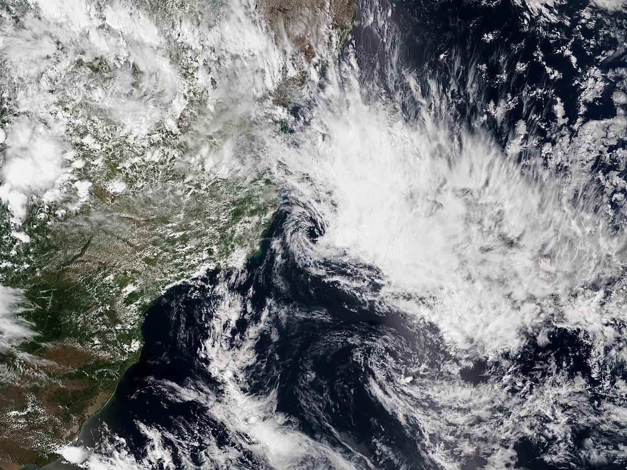
English: Subtropical Storm Guará east of bahia , Brazil on 9 December 2017. |
| Date | |
| Source | NOAA View |
| Author | VIIRS image captured by the National Oceanic and Atmospheric Administration’s Suomi NPP satellite |
| Camera location | | View this and other nearby images on: OpenStreetMap |
|---|
Licensing
edit
This image is in the public domain because it contains materials that originally came from the U.S. National Oceanic and Atmospheric Administration, taken or made as part of an employee's official duties.
|
File history
Click on a date/time to view the file as it appeared at that time.
| Date/Time | Thumbnail | Dimensions | User | Comment | |
|---|---|---|---|---|---|
| current | 14:49, 12 December 2017 | | 5,600 × 4,200 (7.95 MB) | Meow (talk | contribs) | Reverted to version as of 14:06, 10 December 2017 (UTC) What is the purpose of replacing? |
| 21:31, 11 December 2017 |  | 5,665 × 7,985 (3.32 MB) | Typhoon2013 (talk | contribs) | rectangular | |
| 14:06, 10 December 2017 |  | 5,600 × 4,200 (7.95 MB) | Meow (talk | contribs) | User created page with UploadWizard |
You cannot overwrite this file.
File usage on Commons
The following 4 pages use this file:
.jpg)
File usage on other wikis
The following other wikis use this file:
- Usage on pt.wikipedia.org