File:Guchol 2012-06-13 0340Z IR.png
Size of this preview: 800 × 450 pixels. Other resolutions: 320 × 180 pixels | 640 × 360 pixels | 1,024 × 576 pixels | 1,280 × 720 pixels | 1,920 × 1,080 pixels.
Original file (1,920 × 1,080 pixels, file size: 11.22 MB, MIME type: image/png)
Captions
Captions
Add a one-line explanation of what this file represents
Summary
edit
| Description |
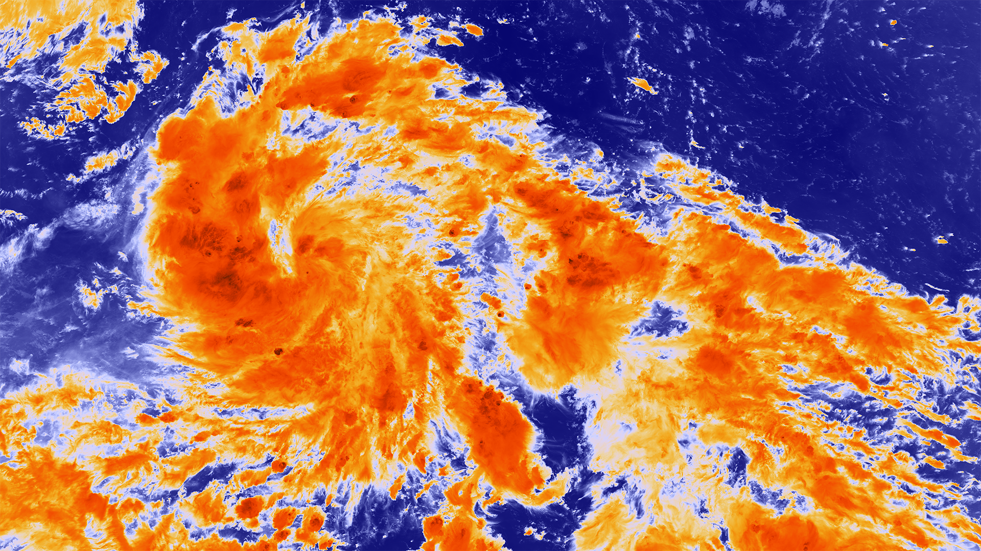
English: Tropical Storm Guchol is located 550 miles southwest of Guam and heading on a northwesterly course with maximum sustained winds of around 51 mph. Over the next 72 hours the storm is expected to intensify to a Category 2 typhoon with sustained winds of 98 mph and gusts up to 120 mph. The Joint Typhoon Warning Center has forecast a track that takes the storm east of the Philippines, gradually turning north. The current forecast could put it on track to impact Japan next week. |
| Date | |
| Source | https://www.nnvl.noaa.gov/MediaDetail2.php?MediaID=1092&MediaTypeID=1 |
| Author | NASA |
Licensing
edit
| This file is in the public domain in the United States because it was solely created by NASA. NASA copyright policy states that "NASA material is not protected by copyright unless noted". (See Template:PD-USGov, NASA copyright policy page or JPL Image Use Policy.) | ||
 |
Warnings:
|
File history
Click on a date/time to view the file as it appeared at that time.
| Date/Time | Thumbnail | Dimensions | User | Comment | |
|---|---|---|---|---|---|
| current | 09:34, 13 April 2018 | | 1,920 × 1,080 (11.22 MB) | A1Cafel (talk | contribs) | User created page with UploadWizard |
You cannot overwrite this file.
File usage on Commons
There are no pages that use this file.