File:Guebwiller Burgstall Grundriss.jpg
Size of this preview: 657 × 600 pixels. Other resolutions: 263 × 240 pixels | 526 × 480 pixels | 841 × 768 pixels | 1,250 × 1,141 pixels.
Original file (1,250 × 1,141 pixels, file size: 140 KB, MIME type: image/jpeg)
Captions
Captions
Add a one-line explanation of what this file represents
Summary
edit
| Description |
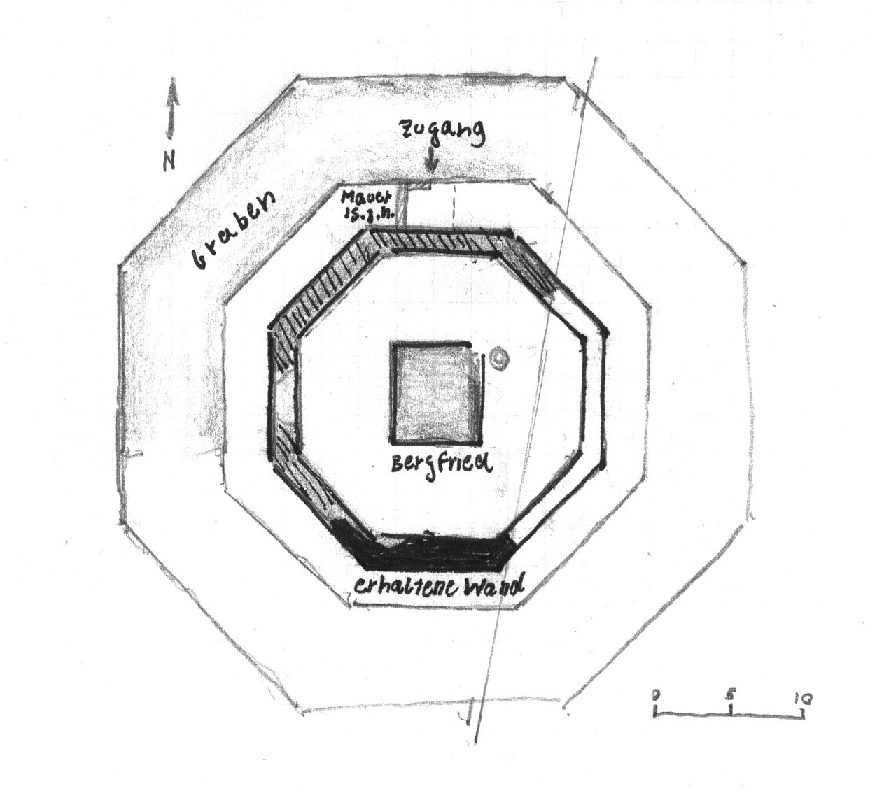
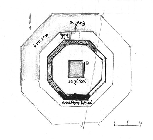
Français : Plan du Château de Burgstall, Guebwiller
Deutsch: "Burgstall" in Guebwiller, Grundriss |
| Date | |
| Source | Eigenes Werk (own work), selbst gezeichnet (nach Charles-Laurent Salch, Dictionnaire des Châteaux de l'Alsace Médiévale) |
| Author | Andreas Rockstein |
| Object location | | View this and other nearby images on: OpenStreetMap |
|---|
|
This building is indexed in the base Mérimée, a database of architectural heritage maintained by the French Ministry of Culture, under the reference IA00054850
|
Licensing
edit
| I, the copyright holder of this work, release this work into the public domain. This applies worldwide. In some countries this may not be legally possible; if so: I grant anyone the right to use this work for any purpose, without any conditions, unless such conditions are required by law. |
File history
Click on a date/time to view the file as it appeared at that time.
| Date/Time | Thumbnail | Dimensions | User | Comment | |
|---|---|---|---|---|---|
| current | 17:39, 18 November 2008 | | 1,250 × 1,141 (140 KB) | Kurpfalzbilder.de (talk | contribs) | {{Information |Description={{fr|1=Plan du Château de Burgstall, Guebwiller}} {{de|1="Burgstall" in Guebwiller, Grundriss}} |Source=Eigenes Werk (own work), selbst gezeichnet (nach ''Charles-Laurent Salch, Dictionnaire des Châteaux de l'Alsace Médiéval |
You cannot overwrite this file.
File usage on Commons
There are no pages that use this file.
File usage on other wikis
The following other wikis use this file:
- Usage on de.wikipedia.org