File:Guipúzcoa 1990 02.jpg
Size of this preview: 800 × 535 pixels. Other resolutions: 320 × 214 pixels | 640 × 428 pixels | 1,028 × 687 pixels.
Original file (1,028 × 687 pixels, file size: 872 KB, MIME type: image/jpeg)
Captions
Captions
Add a one-line explanation of what this file represents
Summary edit
| Description |
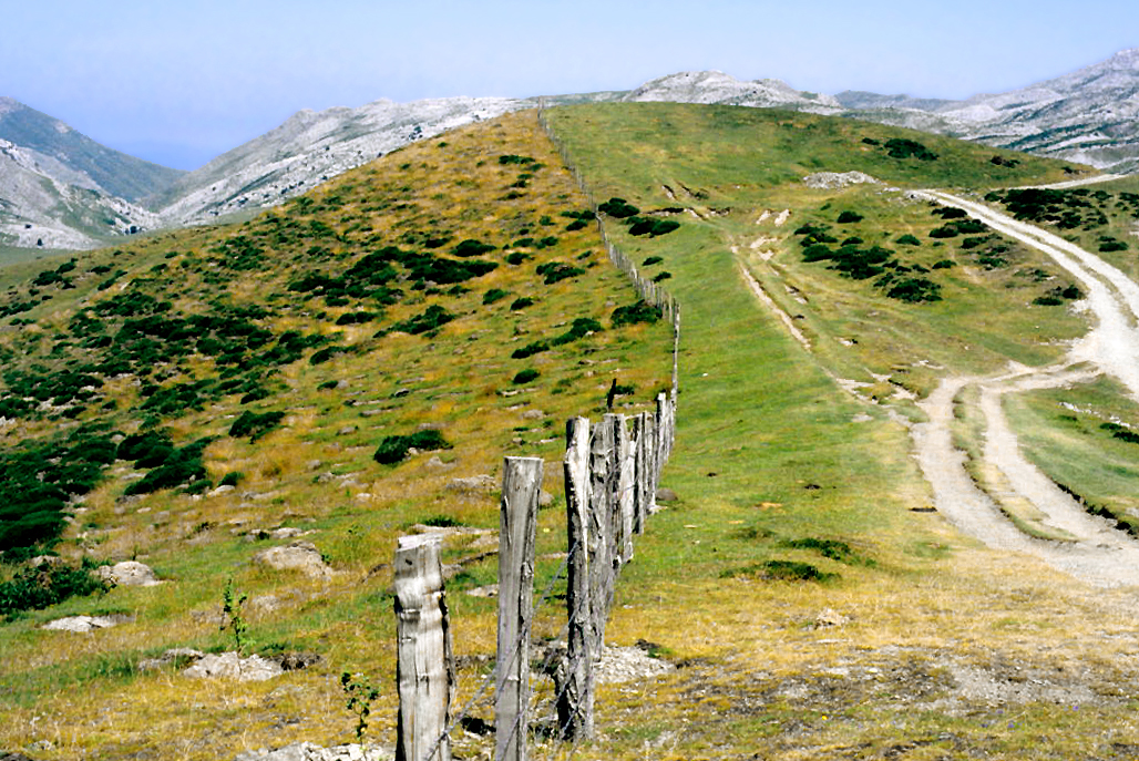
Español: Linde entre la Mancomunidad de Amézqueta y Ordicia (Guipúzcoa, Comunidad Autónoma Vasca) y la facería de Aralar (Navarra), España.
Dos maneras de gestionar el monte: uso cinegético y repoblación de hayas a la izquierda (País Vasco); pastoreo y excursionismo intensivo a la derecha (Navarra)
English: Boundary of two commons: Ametzketa+Ordizia, Gipuzkoa, Basque Autonomous Community, and Sierra de Aralar, Navarre, Spain.
Two ways to manage the forest: hunting ground and beech reforestation on the left side (Basque Country); intensive grazing and hiking on the right one (Navarre) |
| Date | |
| Source | Own work |
| Author | LBM1948 |
Licensing edit
I, the copyright holder of this work, hereby publish it under the following license:
This file is licensed under the Creative Commons Attribution-Share Alike 4.0 International license.
- You are free:
- to share – to copy, distribute and transmit the work
- to remix – to adapt the work
- Under the following conditions:
- attribution – You must give appropriate credit, provide a link to the license, and indicate if changes were made. You may do so in any reasonable manner, but not in any way that suggests the licensor endorses you or your use.
- share alike – If you remix, transform, or build upon the material, you must distribute your contributions under the same or compatible license as the original.
File history
Click on a date/time to view the file as it appeared at that time.
| Date/Time | Thumbnail | Dimensions | User | Comment | |
|---|---|---|---|---|---|
| current | 11:11, 27 November 2021 | | 1,028 × 687 (872 KB) | LBM1948 (talk | contribs) | Uploaded own work with UploadWizard |
You cannot overwrite this file.
File usage on Commons
There are no pages that use this file.