File:Gulf of Aden map hr.svg

Size of this PNG preview of this SVG file: 718 × 600 pixels. Other resolutions: 288 × 240 pixels | 575 × 480 pixels | 920 × 768 pixels | 1,226 × 1,024 pixels | 2,453 × 2,048 pixels | 794 × 663 pixels.
Original file (SVG file, nominally 794 × 663 pixels, file size: 779 KB)
Captions
Captions
Add a one-line explanation of what this file represents
Summary
edit| Description |
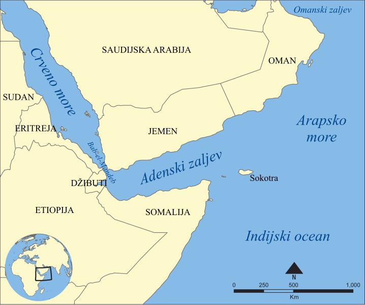
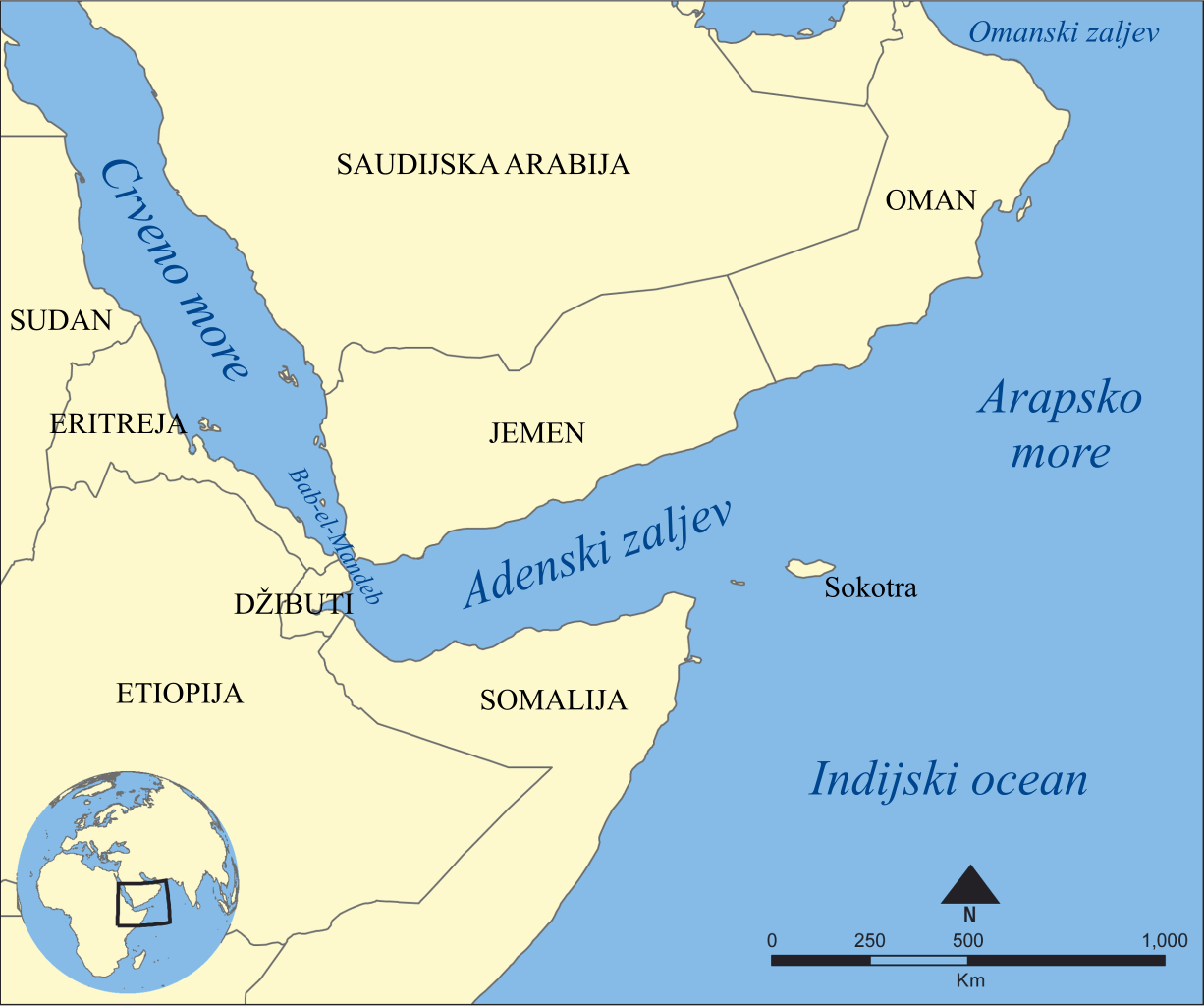
Eesti: Adeni lahe kaart English: Map showing the location of the Gulf of Aden, located between Yemen and Somalia. Nearby bodies of water include the Indian Ocean, Red Sea, Arabian Sea, and the Bab-el-Mandeb Strait. Español: Golfo de Adén, localizado en el Mar arábigo, entre Yemén y Somalia (o Somalilandia). Hrvatski: Adenski zaljev Қазақша: Аден шығанағының орналасуын көрсететін қазақтілді карта. Русский: Карта на казахском языке, показывающяя местоположение Аденского залива. العربية : خريطة تُبيِّن موقع خليج عدن بين اليمن والصومال. المُسطحات المائيَّة المُجاورة هي: المُحيط الهندي والبحر الأحمر وبحر العرب ومضيق باب المندب. |
||
| Date | |||
| Source | Gulf of Aden map.png by NormanEinstein | ||
| Author | Ma▝▖Ga | ||
| Other versions |
[]
|
||
| SVG development |
|


Licensing
edit
I, the copyright holder of this work, hereby publish it under the following licenses:
This file is licensed under the Creative Commons Attribution-Share Alike 3.0 Unported license.
- You are free:
- to share – to copy, distribute and transmit the work
- to remix – to adapt the work
- Under the following conditions:
- attribution – You must give appropriate credit, provide a link to the license, and indicate if changes were made. You may do so in any reasonable manner, but not in any way that suggests the licensor endorses you or your use.
- share alike – If you remix, transform, or build upon the material, you must distribute your contributions under the same or compatible license as the original.

|
Permission is granted to copy, distribute and/or modify this document under the terms of the GNU Free Documentation License, Version 1.2 or any later version published by the Free Software Foundation; with no Invariant Sections, no Front-Cover Texts, and no Back-Cover Texts. A copy of the license is included in the section entitled GNU Free Documentation License. |
You may select the license of your choice.
File history
Click on a date/time to view the file as it appeared at that time.
| Date/Time | Thumbnail | Dimensions | User | Comment | |
|---|---|---|---|---|---|
| current | 13:15, 7 April 2012 | | 794 × 663 (779 KB) | MaGa (talk | contribs) | {{Information |Description={{hr|Adenski zaljev}} |Source=*File:Gulf of Aden map.png |Date=7. travnja 2012. |Author=*Gulf of Aden map.png: NormanEinstein *[[User:MaGa|<font color="Grey">'''Ma''... |
You cannot overwrite this file.
File usage on Commons
The following 7 pages use this file:
File usage on other wikis
The following other wikis use this file:
- Usage on hr.wikipedia.org
- Usage on sh.wikipedia.org
- Usage on www.wikidata.org
- Usage on zh.wikipedia.org