File:Gullion3Dsatelliteview.jpg
Size of this preview: 800 × 280 pixels. Other resolutions: 320 × 112 pixels | 920 × 322 pixels.
Original file (920 × 322 pixels, file size: 86 KB, MIME type: image/jpeg)
Captions
Captions
Add a one-line explanation of what this file represents
Summary
edit
| Description |
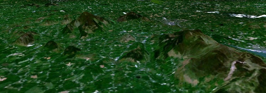
English: Ring of Gullion 3D Satellite View |
| Source | Image from NASA Worldwind |
| Author | NASA |
Licensing
edit
| This image is in the public domain because it is a screenshot from NASA’s globe software World Wind using a public domain layer, such as Blue Marble, MODIS, Landsat, SRTM, USGS or GLOBE.
|
 |
Original upload log
edit
The original description page was here. All following user names refer to en.wikipedia.
- 2005-10-09 14:07 Jonnymccullagh 920×322× (87555 bytes) Ring of Gullion 3D Satellite View, Image from NASA Worldwind
File history
Click on a date/time to view the file as it appeared at that time.
| Date/Time | Thumbnail | Dimensions | User | Comment | |
|---|---|---|---|---|---|
| current | 23:38, 27 April 2013 | 920 × 322 (86 KB) | Hogweard (talk | contribs) | {{Information |Description=Ring of Gullion 3D Satellite View, Image from NASA Worldwind |Source=http://en.wikipedia.org/w/index.php?title=File:Gullion3Dsatelliteview.jpg |Date=9 October 2005 |Author=[en:User:Jonnymccullagh] |Permission={{PD-USGov-NASA}... |
You cannot overwrite this file.
File usage on Commons
There are no pages that use this file.
File usage on other wikis
The following other wikis use this file:
- Usage on en.wikipedia.org