File:Gutum Talji, Hunza, Gilgit-Baltistan, Pakistan (35897623591) (3to4).jpg
No higher resolution available.
Gutum_Talji,_Hunza,_Gilgit-Baltistan,_Pakistan_(35897623591)_(3to4).jpg (669 × 502 pixels, file size: 398 KB, MIME type: image/jpeg)
Captions
Captions
Add a one-line explanation of what this file represents
Summary
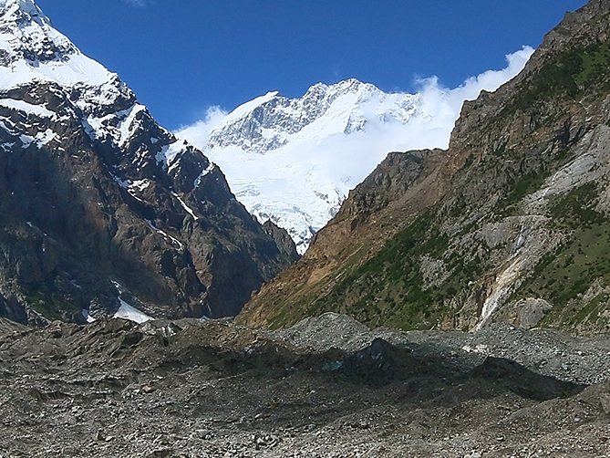
edit| Description |
Muchuhar Glacier and Hachindar Chhish on the left. South face of Batura I in the center in the distance. Viewed from Gutum Talji. |
| Date | |
| Source | Gutum Talji, Hunza, Gilgit-Baltistan, Pakistan |
| Author | Imran Shah from Islamabad, Pakistan |
| Other versions |
.jpg)
_(3to4).jpg&action=edit§ion=1)
| Camera location | | View this and other nearby images on: OpenStreetMap |
|---|
_(3to4).jpg¶ms=036.396041_N_0074.493402_E_globe:Earth_type:camera_source:Flickr_&language=en)
Licensing
edit_(3to4).jpg&action=edit§ion=2)
This file is licensed under the Creative Commons Attribution-Share Alike 2.0 Generic license.
- You are free:
- to share – to copy, distribute and transmit the work
- to remix – to adapt the work
- Under the following conditions:
- attribution – You must give appropriate credit, provide a link to the license, and indicate if changes were made. You may do so in any reasonable manner, but not in any way that suggests the licensor endorses you or your use.
- share alike – If you remix, transform, or build upon the material, you must distribute your contributions under the same or compatible license as the original.
File history
Click on a date/time to view the file as it appeared at that time.
| Date/Time | Thumbnail | Dimensions | User | Comment | |
|---|---|---|---|---|---|
| current | 10:36, 28 April 2022 | | 669 × 502 (398 KB) | PenangLion (talk | contribs) | File:Gutum Talji, Hunza, Gilgit-Baltistan, Pakistan (35897623591).jpg cropped 70 % horizontally, 67 % vertically using CropTool with precise mode. |
You cannot overwrite this file.
File usage on Commons
The following page uses this file:
_(3to4).jpg&oldid=652472677)