File:Hörnum-Odde Sylt.jpg

Size of this preview: 800 × 450 pixels. Other resolutions: 320 × 180 pixels | 640 × 360 pixels | 1,024 × 576 pixels | 1,280 × 720 pixels | 2,032 × 1,143 pixels.
Original file (2,032 × 1,143 pixels, file size: 2.27 MB, MIME type: image/jpeg)
Captions
Captions
Add a one-line explanation of what this file represents
Summary
edit
| Description |
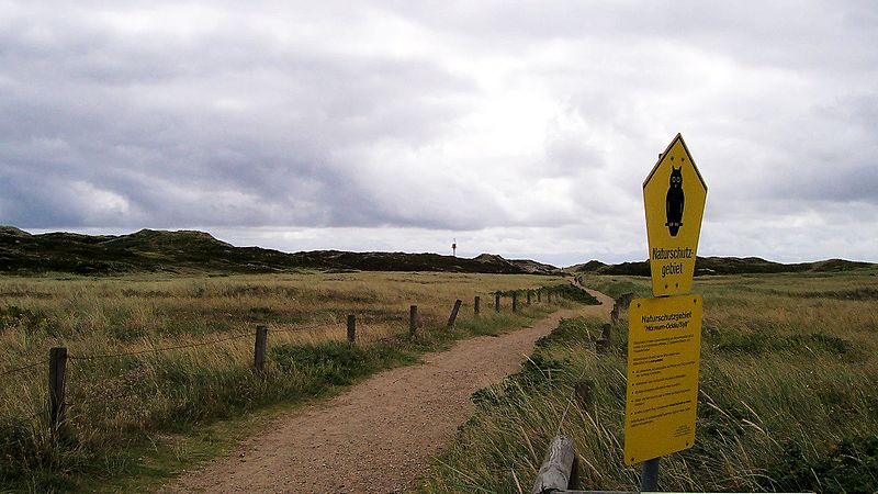
Deutsch: Naturschutzgebiet Hörnum-Odde/Sylt. Hörnum und die Hörnum-Odde befinden sich an der Südspitze der Insel Sylt. Die Hörnum-Odde ist eine Heide- und Dünenlandschaft auf der Insel Sylt. Diese ist durch Gezeiten sehr geprägt und immer wieder durch Sturmfluten sehr stark gefährdet. Seit 1972 steht dieses Gebiet unter Naturschutz. |
| Date | 12 August 2005, 12:34:45 |
| Source | Own work |
| Author | Thorsten Meisner |
| Camera location | | View this and other nearby images on: OpenStreetMap |
|---|
Licensing
edit
I, the copyright holder of this work, hereby publish it under the following license:
This file is licensed under the Creative Commons Attribution-Share Alike 4.0 International license.
- You are free:
- to share – to copy, distribute and transmit the work
- to remix – to adapt the work
- Under the following conditions:
- attribution – You must give appropriate credit, provide a link to the license, and indicate if changes were made. You may do so in any reasonable manner, but not in any way that suggests the licensor endorses you or your use.
- share alike – If you remix, transform, or build upon the material, you must distribute your contributions under the same or compatible license as the original.
This image was uploaded as part of Wiki Loves Earth 2016.
|
 |
File history
Click on a date/time to view the file as it appeared at that time.
| Date/Time | Thumbnail | Dimensions | User | Comment | |
|---|---|---|---|---|---|
| current | 20:58, 31 May 2016 | | 2,032 × 1,143 (2.27 MB) | TMeisner (talk | contribs) | User created page with UploadWizard |
You cannot overwrite this file.
File usage on Commons
The following 2 pages use this file:
File usage on other wikis
The following other wikis use this file:
- Usage on de.wikipedia.org
- Usage on www.wikidata.org