File:Hörnum Odde 2017.jpg
Size of this preview: 800 × 600 pixels. Other resolutions: 320 × 240 pixels | 640 × 480 pixels | 1,024 × 768 pixels | 1,280 × 960 pixels | 2,560 × 1,920 pixels | 4,000 × 3,000 pixels.
Original file (4,000 × 3,000 pixels, file size: 2.85 MB, MIME type: image/jpeg)
Captions
Captions
Add a one-line explanation of what this file represents
Summary edit
| Description |
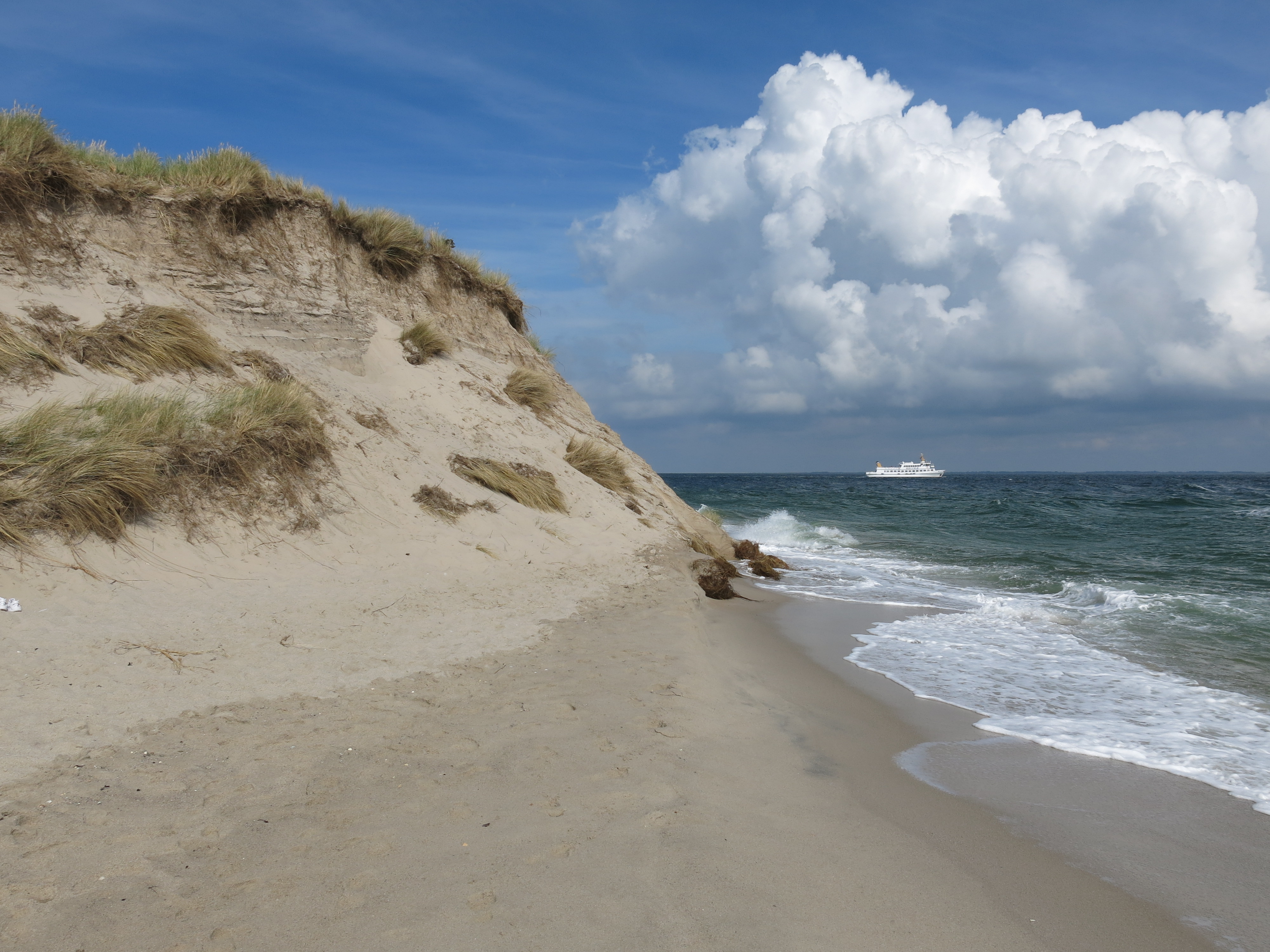
Deutsch: Die Hörnum-Odde bei normalem Hochwasser im Sommer 2017: Für das Umrunden der Südspitze Sylts zu Fuß muss ein niedrigerer Wasserstand abgewartet werden, da auch bei regulären Höchsttänden der Flut das Wasser bis an den Dünensaum reicht.
English: The Hörnum Odde during normal flooding in the summer of 2017: For passing by the southern tip of Sylt by foot a lower water level must be waited on, as even at regular high tides the flood reaches the water to the edge of the dune. |
| Date | |
| Source | Own work |
| Author | Jörg Braukmann |
| Camera location | | View this and other nearby images on: OpenStreetMap |
|---|
Licensing edit
I, the copyright holder of this work, hereby publish it under the following license:
This file is licensed under the Creative Commons Attribution-Share Alike 4.0 International license.
- You are free:
- to share – to copy, distribute and transmit the work
- to remix – to adapt the work
- Under the following conditions:
- attribution – You must give appropriate credit, provide a link to the license, and indicate if changes were made. You may do so in any reasonable manner, but not in any way that suggests the licensor endorses you or your use.
- share alike – If you remix, transform, or build upon the material, you must distribute your contributions under the same or compatible license as the original.

|
This image has been assessed under the valued image criteria and is considered the most valued image on Commons within the scope: Loss of land at Hörnum Odde in 2017. You can see its nomination here. |
File history
Click on a date/time to view the file as it appeared at that time.
| Date/Time | Thumbnail | Dimensions | User | Comment | |
|---|---|---|---|---|---|
| current | 12:36, 20 January 2018 | | 4,000 × 3,000 (2.85 MB) | Milseburg (talk | contribs) | User created page with UploadWizard |
You cannot overwrite this file.
File usage on Commons
The following page uses this file:
File usage on other wikis
The following other wikis use this file:
- Usage on de.wikipedia.org