File:HBW 6b.JPG

Size of this preview: 596 × 599 pixels. Other resolutions: 239 × 240 pixels | 477 × 480 pixels | 764 × 768 pixels | 1,018 × 1,024 pixels | 1,457 × 1,465 pixels.
Original file (1,457 × 1,465 pixels, file size: 221 KB, MIME type: image/jpeg)
Captions
Captions
Add a one-line explanation of what this file represents
Summary
edit
| Description |
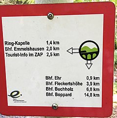
Deutsch: Wegweiser des Hunsrückbahnwanderweges |
| Date | |
| Source | Self-photographed |
| Author | User Pathumthani |
| Camera location | | View this and other nearby images on: OpenStreetMap |
|---|
https://www.openstreetmap.org/node/5788980966
Licensing
edit
I, the copyright holder of this work, hereby publish it under the following license:
This file is licensed under the Creative Commons Attribution-Share Alike 4.0 International license.
- You are free:
- to share – to copy, distribute and transmit the work
- to remix – to adapt the work
- Under the following conditions:
- attribution – You must give appropriate credit, provide a link to the license, and indicate if changes were made. You may do so in any reasonable manner, but not in any way that suggests the licensor endorses you or your use.
- share alike – If you remix, transform, or build upon the material, you must distribute your contributions under the same or compatible license as the original.
File history
Click on a date/time to view the file as it appeared at that time.
| Date/Time | Thumbnail | Dimensions | User | Comment | |
|---|---|---|---|---|---|
| current | 14:05, 27 July 2018 | | 1,457 × 1,465 (221 KB) | Pathumthani (talk | contribs) | {{Information |description ={{de|1=Wegweiser des Hunsrückbahnwanderweges}} |date =2018-07-17 |source =eigenes Foto |author =User Pathumthani }} https://www.openstreetmap.org/node/5788980966 Category:Hiking and footpath signs in Rhineland-Palatinate |
You cannot overwrite this file.
File usage on Commons
There are no pages that use this file.