File:HUC 031300010602 topographic map.tiff
Size of this PNG preview of this TIF file: 330 × 599 pixels. Other resolutions: 132 × 240 pixels | 264 × 480 pixels | 790 × 1,434 pixels.
Original file (790 × 1,434 pixels, file size: 3.1 MB, MIME type: image/tiff)
Captions
Captions
Add a one-line explanation of what this file represents
Summary edit
| Description |
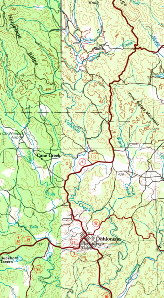
English: HUC 031300010602 topographical map, using a combination of the 1981 Dalton 30x60 grid and the 1981 Toccoa 30x60 grid, showing Yahoola Creek and the Chestatee River. Also shows HUC 031300010602 - Cane Creek in the western part of the map. |
| Date | |
| Source | combination of GA_Dalton_247638_1981_100000_geo.pdf and GA_Toccoa_247664_1981_100000_geo.pdf downloaded from store.usgs.gov |
| Author | USGS |
Licensing edit
This image is in the public domain in the United States because it only contains materials that originally came from the United States Geological Survey, an agency of the United States Department of the Interior. For more information, see the official USGS copyright policy.
|
File history
Click on a date/time to view the file as it appeared at that time.
| Date/Time | Thumbnail | Dimensions | User | Comment | |
|---|---|---|---|---|---|
| current | 17:12, 5 January 2016 |  | 790 × 1,434 (3.1 MB) | Concertmusic (talk | contribs) | User created page with UploadWizard |
You cannot overwrite this file.
File usage on Commons
There are no pages that use this file.
File usage on other wikis
The following other wikis use this file:
- Usage on en.wikipedia.org