File:Halbinsel Au - Horgen - Zimmerberg - Uetliberg - Zürich - Zürichsee - Pfannenstiel - Feusisberg - Etzel 2010-10-21 15-13-00.JPG

Size of this preview: 800 × 531 pixels. Other resolutions: 320 × 213 pixels | 640 × 425 pixels | 1,024 × 680 pixels | 1,280 × 850 pixels | 2,560 × 1,700 pixels | 4,288 × 2,848 pixels.
Original file (4,288 × 2,848 pixels, file size: 6.34 MB, MIME type: image/jpeg)
Captions
Captions
Add a one-line explanation of what this file represents
Summary edit
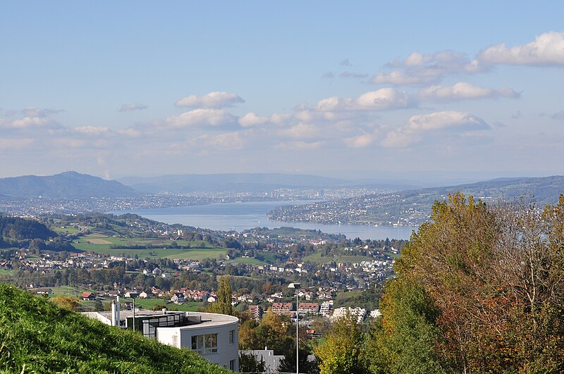
| Description | Samstagern and Zimmerberg plateau, as seen from Schindellegi respectively Feusisberg (Switzerland) towards Etzel mountain, (from the left:) Uetliberg mountain, Horgen, Halbinsel Au and Zürichsee, Zürich in the background, and northwestern Pfannenstiel mountain to the right. |
| Date | |
| Source | Own work |
| Author | Roland zh |
| Other versions |
|

| Camera location | | View this and other nearby images on: OpenStreetMap |
|---|
Licensing edit
I, the copyright holder of this work, hereby publish it under the following license:
This file is licensed under the Creative Commons Attribution-Share Alike 3.0 Unported license.
- You are free:
- to share – to copy, distribute and transmit the work
- to remix – to adapt the work
- Under the following conditions:
- attribution – You must give appropriate credit, provide a link to the license, and indicate if changes were made. You may do so in any reasonable manner, but not in any way that suggests the licensor endorses you or your use.
- share alike – If you remix, transform, or build upon the material, you must distribute your contributions under the same or compatible license as the original.
File history
Click on a date/time to view the file as it appeared at that time.
| Date/Time | Thumbnail | Dimensions | User | Comment | |
|---|---|---|---|---|---|
| current | 00:13, 24 October 2010 | | 4,288 × 2,848 (6.34 MB) | Roland zh (talk | contribs) | == {{int:filedesc}} == {{Information |Description= Samstagern and ''Zimmerberg'' plateau, as seen from Schindellegi respectively Feusisberg (Switzerland) towards [[ |
You cannot overwrite this file.
File usage on Commons
There are no pages that use this file.