File:Hallstatt Salzberghochtal 1957.jpg
Size of this preview: 600 × 600 pixels. Other resolutions: 240 × 240 pixels | 480 × 480 pixels | 768 × 768 pixels | 1,024 × 1,024 pixels | 1,500 × 1,500 pixels.
Original file (1,500 × 1,500 pixels, file size: 661 KB, MIME type: image/jpeg)
Captions
Captions
Add a one-line explanation of what this file represents
Summary
edit| Description |
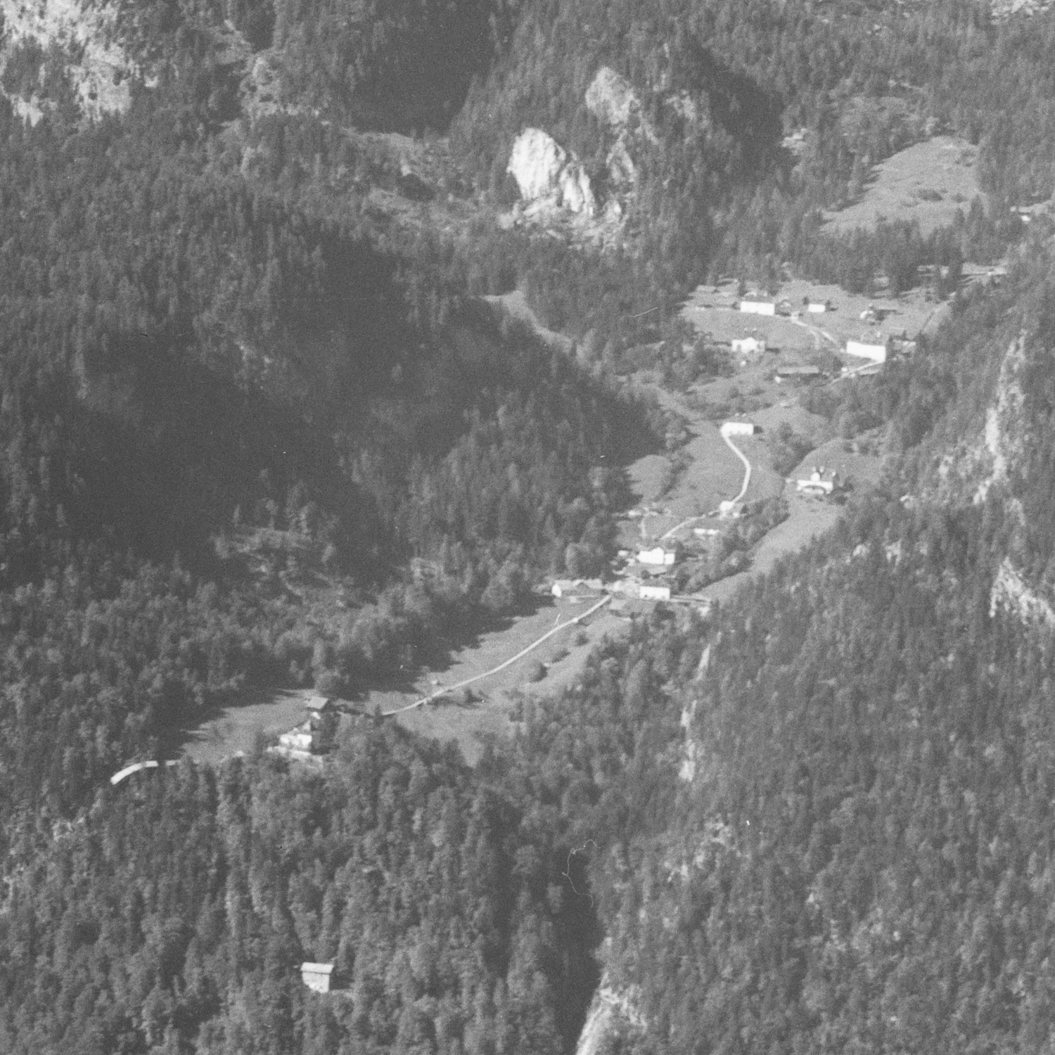
Deutsch: Ausschnitt aus einer Luftaufnahme von Hallstatt, Hallstätter See, Salzberg und Plassen, der das Hochtal mit der Bergbausiedlung und dem Areal des prähistorischen Gräberfelds zeigt.
English: Cropped aerial view of Hallstatt that shows the settlement near the salt mine und the area of the prehistoric burial ground.
|
||||||||||||||||
| Date | |||||||||||||||||
| Source |
http://doi.org/10.3932/ethz-a-000446666 |
||||||||||||||||
| Author |
|
||||||||||||||||
| Permission (Reusing this file) |
This file is licensed under the Creative Commons Attribution-Share Alike 4.0 International license.
|
||||||||||||||||
| Other versions | |||||||||||||||||
| Object location | | View this and other nearby images on: OpenStreetMap |
|---|
Licensing
edit
This file is licensed under the Creative Commons Attribution-Share Alike 4.0 International license.
- You are free:
- to share – to copy, distribute and transmit the work
- to remix – to adapt the work
- Under the following conditions:
- attribution – You must give appropriate credit, provide a link to the license, and indicate if changes were made. You may do so in any reasonable manner, but not in any way that suggests the licensor endorses you or your use.
- share alike – If you remix, transform, or build upon the material, you must distribute your contributions under the same or compatible license as the original.
| This is a retouched picture, which means that it has been digitally altered from its original version. Modifications: Cropped and converted to jpg.. Modifications made by AStiasny.
|
| Annotations | This image is annotated: View the annotations at Commons |
File history
Click on a date/time to view the file as it appeared at that time.
| Date/Time | Thumbnail | Dimensions | User | Comment | |
|---|---|---|---|---|---|
| current | 18:37, 17 June 2019 | | 1,500 × 1,500 (661 KB) | AStiasny (talk | contribs) | User created page with UploadWizard |
You cannot overwrite this file.
File usage on Commons
The following 2 pages use this file: