File:Hamburger Bürgerschaftswahlkreise 2015.svg

Size of this PNG preview of this SVG file: 717 × 600 pixels. Other resolutions: 287 × 240 pixels | 574 × 480 pixels | 918 × 768 pixels | 1,224 × 1,024 pixels | 2,449 × 2,048 pixels | 1,100 × 920 pixels.
Original file (SVG file, nominally 1,100 × 920 pixels, file size: 1.08 MB)
Captions
Captions
Add a one-line explanation of what this file represents
Summary edit
| Description |
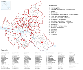
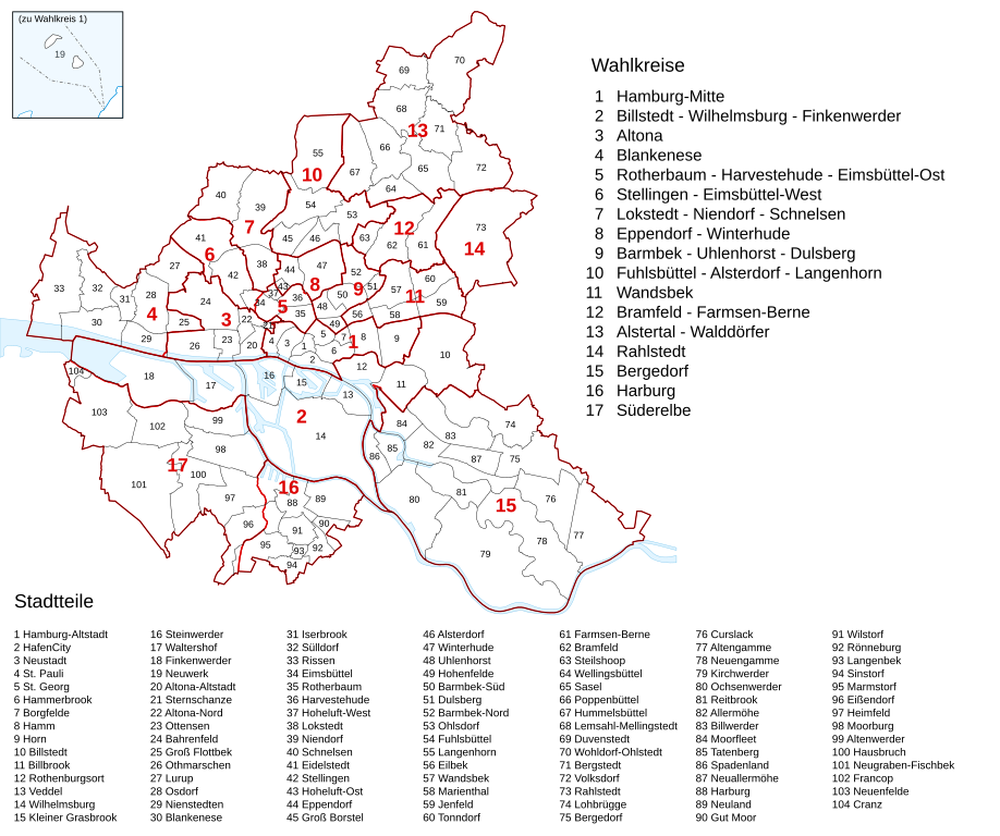
Deutsch: Karte der Wahlkreise zur Hamburger Bürgerschaft mit den Stadtteilen (2015). |
||
| Date | |||
| Source | Own work, based on maps of the Landeswahlamt Hamburg | ||
| Author | Furfur | ||
| Permission (Reusing this file) |
I, the copyright holder of this work, hereby publish it under the following licenses:
This file is licensed under the Creative Commons Attribution-Share Alike 4.0 International license.
You may select the license of your choice. |
||
| SVG development | This map was created with Adobe Illustrator. |

File history
Click on a date/time to view the file as it appeared at that time.
| Date/Time | Thumbnail | Dimensions | User | Comment | |
|---|---|---|---|---|---|
| current | 12:35, 10 September 2019 | | 1,100 × 920 (1.08 MB) | Furfur (talk | contribs) | kleine Detailkorrektur |
| 23:25, 9 September 2019 |  | 1,100 × 920 (1.08 MB) | Furfur (talk | contribs) | == {{int:filedesc}} == {{Information |Description={{User:Medium69/Traduction}} {{de|1=Karte der Wahlkreise zur Hamburger Bürgerschaft mit den Stadtteilen (2015).}} |Source={{own}}, based on maps of the Landeswahlamt Hamburg |Date=2019-09-09 |Author={{U|Furfur}} |Permission={{self|GFDL|cc-by-sa-4.0}} |Other versions= |Other fields={{Igen|A|+|%|s=m}} }} Category:Election maps of Hamburg |
You cannot overwrite this file.
File usage on Commons
The following page uses this file:
File usage on other wikis
The following other wikis use this file:
- Usage on de.wikipedia.org