File:Hampshire County Courthouse Romney WV 2014 10 05 05.JPG

Size of this preview: 800 × 600 pixels. Other resolutions: 320 × 240 pixels | 640 × 480 pixels | 1,024 × 768 pixels | 1,280 × 960 pixels | 2,560 × 1,920 pixels | 3,264 × 2,448 pixels.
Original file (3,264 × 2,448 pixels, file size: 2.02 MB, MIME type: image/jpeg)
Captions
Captions
Add a one-line explanation of what this file represents
Summary
edit
| Description |
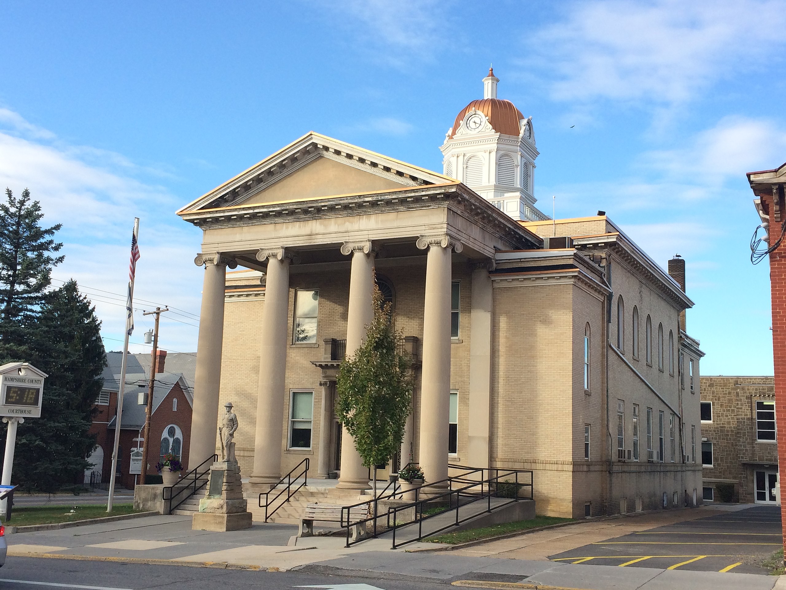
English: The Hampshire County Courthouse in Romney, West Virginia, following the restoration of its dome. Photographed by Justin A. Wilcox of Washington, D.C. on October 5, 2014. |
| Date | |
| Source | Own work |
| Author | Justin.A.Wilcox |
| Camera location | | View this and other nearby images on: OpenStreetMap |
|---|
|
This is an image of a place or building that is listed on the National Register of Historic Places in the United States of America. Its reference number is 05001006. |
Licensing
edit
I, the copyright holder of this work, hereby publish it under the following license:
This file is licensed under the Creative Commons Attribution-Share Alike 4.0 International license.
- You are free:
- to share – to copy, distribute and transmit the work
- to remix – to adapt the work
- Under the following conditions:
- attribution – You must give appropriate credit, provide a link to the license, and indicate if changes were made. You may do so in any reasonable manner, but not in any way that suggests the licensor endorses you or your use.
- share alike – If you remix, transform, or build upon the material, you must distribute your contributions under the same or compatible license as the original.
File history
Click on a date/time to view the file as it appeared at that time.
| Date/Time | Thumbnail | Dimensions | User | Comment | |
|---|---|---|---|---|---|
| current | 22:41, 6 October 2014 | | 3,264 × 2,448 (2.02 MB) | Quercus montana (talk | contribs) | User created page with UploadWizard |
You cannot overwrite this file.
File usage on Commons
There are no pages that use this file.
File usage on other wikis
The following other wikis use this file:
- Usage on en.wikipedia.org
- Hampshire County, West Virginia
- Talk:Hampshire County, West Virginia
- Talk:Potomac River
- Talk:Randall Terry
- Talk:U.S. Route 220
- Talk:Romney, West Virginia
- List of historic sites in Hampshire County, West Virginia
- Talk:George Washington and Jefferson National Forests
- Talk:List of historical highway markers in Hampshire County, West Virginia
- Talk:Henepola Gunaratana
- Talk:Indian Mound Cemetery
- Talk:Confederate Memorial (Romney, West Virginia)
- Talk:33rd Virginia Infantry Regiment
- Talk:Stephen Ailes
- Talk:Kirby, West Virginia
- Talk:Jonah Edward Kelley
- Template talk:Eastern panhandle of West Virginia
- Talk:Winchester and Western Railroad
- Talk:Potomac Eagle Scenic Railroad
- Talk:South Branch Valley Railroad
- Talk:Battle of Great Cacapon
- Talk:Cacapon Mountain
- Talk:Ruth Rowan
- Talk:Ken Hechler
- Talk:W. Willard Wirtz
- Talk:Alexander White (Virginia politician)
- Talk:Joseph Neville
- Talk:Timber Ridge
- Talk:Great North Mountain
- Talk:Fort Mill Ridge Civil War Trenches
- Talk:Felix Walker (American politician)
- Talk:Northwestern Turnpike
- Talk:Great Appalachian Valley
- Talk:Charles S. Lawrence
- Talk:Piss Pot Island
- Talk:The Devil's Nose
- Talk:Sloan–Parker House
- Talk:Wilson-Wodrow-Mytinger House
- Talk:Romney, West Virginia, in the American Civil War
- Talk:Sam Pancake
- Talk:West Virginia Route 127
- Talk:West Virginia Route 259
- Talk:West Virginia Route 28
- Talk:West Virginia Route 9
- Talk:West Virginia Route 29
- Talk:Chet Pancake
- Talk:West Virginia Schools for the Deaf and the Blind
- Talk:Mechanicsburg Gap
- Talk:John J. Jacob (West Virginia politician)
- Talk:John J. Cornwell
View more global usage of this file.