File:Hampton Down stone circle - geograph.org.uk - 242207.jpg
No higher resolution available.
Hampton_Down_stone_circle_-_geograph.org.uk_-_242207.jpg (640 × 319 pixels, file size: 84 KB, MIME type: image/jpeg)
Captions
Captions
Add a one-line explanation of what this file represents
Summary
edit
| Description |
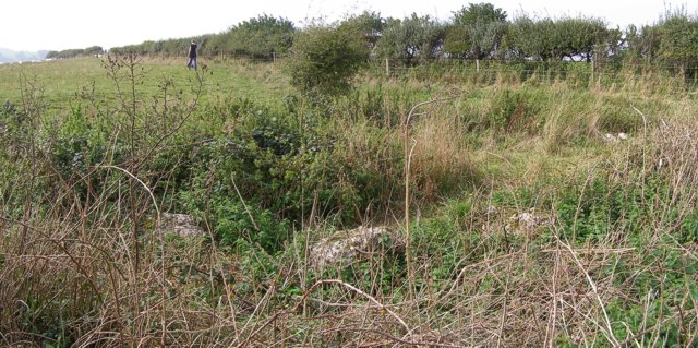
English: Hampton Down stone circle. This rather overgrown neolithic stone circle lies alongside the inland coast path on Hampton Down above Portesham. A sign on the stile next to the circle reads: "THIS STONE CIRCLE IS AN ANCIENT MONUMENT SCHEDULED BY THE MINISTRY OF PUBLIC BUILDING AND WORKS. IT WAS EXCAVATED IN 1965 AND THE STONES RE-INSTATED IN THEIR ORIGINAL SOCKETS. THE ORIGINAL CIRCLE WAS PROBABLY CONSTRUCTED BETWEEN 1800 AND 1200 B.C. STRUCTURES OF THIS TYPE ARE CONSIDERED TO HAVE HAD A RITUAL SIGNIFICANCE." A few years ago the site was cleared of brambles, but nature has reclaimed it once again. |
| Date | |
| Source | From geograph.org.uk |
| Author | Jim Champion |
| Attribution (required by the license) | Jim Champion / Hampton Down stone circle / |
| Object location | | View this and other nearby images on: OpenStreetMap |
|---|
_heading:67.00&language=en)
Licensing
edit

|
This image was taken from the Geograph project collection. See this photograph's page on the Geograph website for the photographer's contact details. The copyright on this image is owned by Jim Champion and is licensed for reuse under the Creative Commons Attribution-ShareAlike 2.0 license.
|
This file is licensed under the Creative Commons Attribution-Share Alike 2.0 Generic license.
Attribution: Jim Champion
- You are free:
- to share – to copy, distribute and transmit the work
- to remix – to adapt the work
- Under the following conditions:
- attribution – You must give appropriate credit, provide a link to the license, and indicate if changes were made. You may do so in any reasonable manner, but not in any way that suggests the licensor endorses you or your use.
- share alike – If you remix, transform, or build upon the material, you must distribute your contributions under the same or compatible license as the original.
- Remove redundant categories and try to put this image in the most specific category/categories
- Remove this template
- The location categories are based on information from this geonames tool and this OpenStreetMap tool combined with a database. You can also have a look at this tool from mysociety.
- The topic category from Geograph was Stone circle (find similar images circle at Geograph)
File history
Click on a date/time to view the file as it appeared at that time.
| Date/Time | Thumbnail | Dimensions | User | Comment | |
|---|---|---|---|---|---|
| current | 15:32, 1 February 2010 | | 640 × 319 (84 KB) | GeographBot (talk | contribs) | == {{int:filedesc}} == {{Information |description={{en|1=Hampton Down stone circle. This rather overgrown neolithic stone circle lies alongside the inland coast path on Hampton Down above Portesham. A sign on the stile next to the circle reads: "THIS STON |
You cannot overwrite this file.
File usage on Commons
There are no pages that use this file.
File usage on other wikis
The following other wikis use this file:
- Usage on en.wikipedia.org
- Usage on fr.wikipedia.org
- Usage on www.wikidata.org