File:Hannover Stadtbahn B Nord.png
Size of this preview: 485 × 600 pixels. Other resolutions: 194 × 240 pixels | 388 × 480 pixels | 875 × 1,082 pixels.
Original file (875 × 1,082 pixels, file size: 405 KB, MIME type: image/png)
Captions
Captions
Add a one-line explanation of what this file represents
| Description |
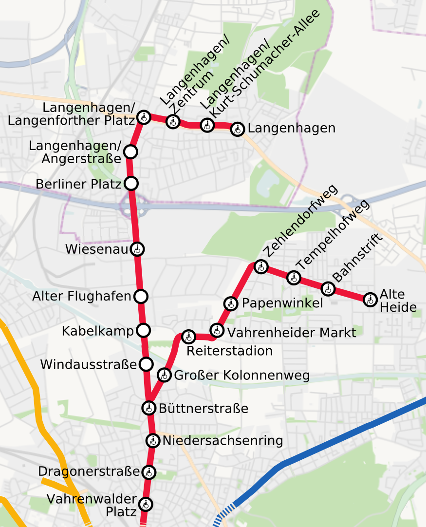
English: Light rail of Hannover, Germany. B North
Deutsch: Stadtbahn Hannover, Teilnetz B Nord |
||||||||||||
| Date | |||||||||||||
| Source | Own work, background: OpenStreetMap data | ||||||||||||
| Author | Jeremiah21 | ||||||||||||
| Permission (Reusing this file) |
|

|
This transport map image could be re-created using vector graphics as an SVG file. This has several advantages; see Commons:Media for cleanup for more information. If an SVG form of this image is available, please upload it and afterwards replace this template with
{{vector version available|new image name}}.
It is recommended to name the SVG file “Hannover Stadtbahn B Nord.svg”—then the template Vector version available (or Vva) does not need the new image name parameter. |

|
This map has been made or improved in the German Kartenwerkstatt (Map Lab). You can propose maps to improve as well.
|
File history
Click on a date/time to view the file as it appeared at that time.
| Date/Time | Thumbnail | Dimensions | User | Comment | |
|---|---|---|---|---|---|
| current | 18:00, 7 February 2024 | | 875 × 1,082 (405 KB) | NordNordWest (talk | contribs) | update for User:Nixblicker |
| 15:53, 21 February 2010 |  | 875 × 1,082 (509 KB) | Jeremiah21 (talk | contribs) | corr | |
| 19:53, 19 February 2010 |  | 875 × 1,082 (507 KB) | Jeremiah21 (talk | contribs) | {{Information |Description={{en|1=Light rail of Hannover, Germany. B North}} {{de|1=Stadtbahn Hannover, Teilnetz B Nord }} |Source={{Own}}, background: OpenStreetMap data |Author={{U|Jeremiah21}} |Date=2010-02-19 |Permission={{OpenStreetMap}} |other_versi |
You cannot overwrite this file.
File usage on Commons
The following 3 pages use this file:
File usage on other wikis
The following other wikis use this file:
- Usage on de.wikipedia.org