File:Happy-Isles-topo-map.jpg
Size of this preview: 682 × 600 pixels. Other resolutions: 273 × 240 pixels | 546 × 480 pixels | 873 × 768 pixels | 1,164 × 1,024 pixels | 2,192 × 1,928 pixels.
Original file (2,192 × 1,928 pixels, file size: 1.32 MB, MIME type: image/jpeg)
Captions
Captions
Add a one-line explanation of what this file represents
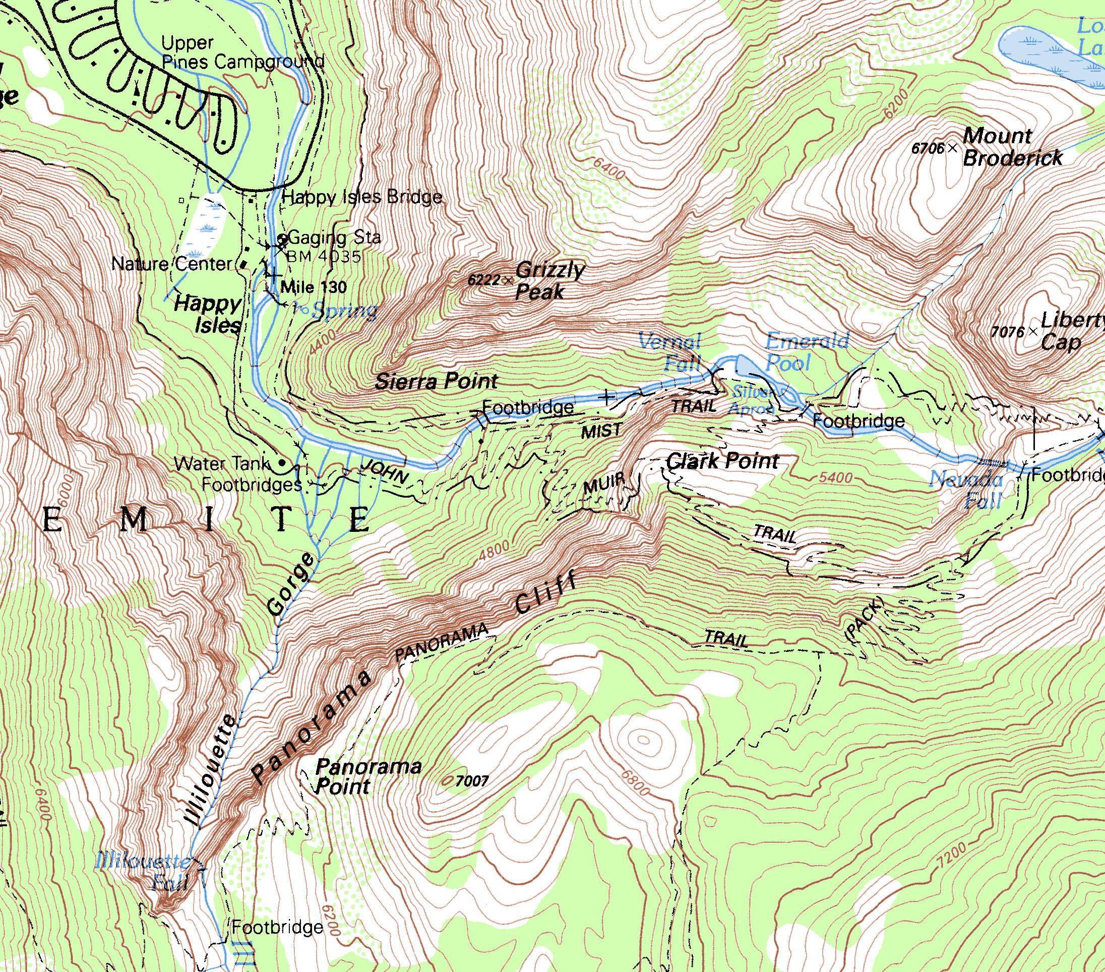
| Description | Topographic Map of the Happy Isles, Mist Trail area, Yosemite National Park | |||
| Date | ||||
| Source | https://ngmdb.usgs.gov/topoview/viewer/#15/37.7245/-119.5458 | |||
| Author | USGS | |||
| Permission (Reusing this file) |
|
File history
Click on a date/time to view the file as it appeared at that time.
| Date/Time | Thumbnail | Dimensions | User | Comment | |
|---|---|---|---|---|---|
| current | 20:19, 10 May 2008 | | 2,192 × 1,928 (1.32 MB) | Eeekster (talk | contribs) | {{Information |Description=Topographic Map of the Happy Isles, Mist Trail area |Source=http://casil.ucdavis.edu/casil/maps/drg/ |Date= |Author=USGS |Permission= |other_versions= }} {{PD-USGov-USGS}} Topographic Map of the Happy Isles Area, Yosemite Natio |
You cannot overwrite this file.
File usage on Commons
There are no pages that use this file.
File usage on other wikis
The following other wikis use this file:
- Usage on en.wikipedia.org
- Usage on ru.wikipedia.org
- Usage on www.wikidata.org