File:Harvey 2017-08-26 0055Z.jpg

Size of this preview: 711 × 600 pixels. Other resolutions: 285 × 240 pixels | 569 × 480 pixels | 911 × 768 pixels | 1,214 × 1,024 pixels | 1,742 × 1,469 pixels.
Original file (1,742 × 1,469 pixels, file size: 229 KB, MIME type: image/jpeg)
Captions
Captions
Add a one-line explanation of what this file represents
Summary
edit
| Description |
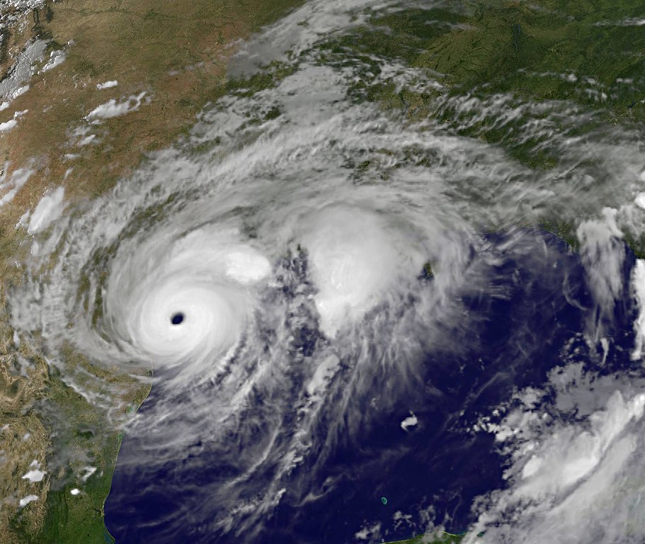
English: At 8:55 p.m. EDT when Harvey's large eye was at the coast between Port Aransas and Port O'Connor, NOAA's GOES East satellite provided an infrared picture of the massive storm. The eye appeared clear in the image created at NASA/NOAA GOES Project at NASA's Goddard Space Flight Center, Greenbelt, Maryland. |
| Date | |
| Source | https://www.nasa.gov/feature/goddard/2017/harvey-atlantic-ocean |
| Author | NASA/NOAA |
Licensing
edit
This image is in the public domain because it contains materials that originally came from the U.S. National Oceanic and Atmospheric Administration, taken or made as part of an employee's official duties.
|
File history
Click on a date/time to view the file as it appeared at that time.
| Date/Time | Thumbnail | Dimensions | User | Comment | |
|---|---|---|---|---|---|
| current | 13:21, 6 February 2018 | | 1,742 × 1,469 (229 KB) | A1Cafel (talk | contribs) | original size |
| 09:15, 29 September 2017 |  | 985 × 831 (97 KB) | A1Cafel (talk | contribs) | User created page with UploadWizard |
You cannot overwrite this file.
File usage on Commons
The following page uses this file: