File:Head of the path up Hengwm - geograph.org.uk - 715588.jpg
Size of this preview: 800 × 536 pixels. Other resolutions: 320 × 214 pixels | 640 × 429 pixels | 1,000 × 670 pixels.
Original file (1,000 × 670 pixels, file size: 239 KB, MIME type: image/jpeg)
Captions
Captions
Add a one-line explanation of what this file represents
Summary
edit
| Description |
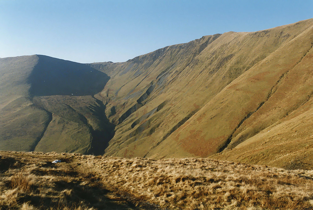
English: Head of the path up Hengwm After its long and even climb up the side of Hengwm, the path finally levels out at Waun Goch. Looking across Hengwm, the very distinctive, almost sculptured, slopes descending from Drws Bach can be seen. Taken on a beautifully crisp January day. |
| Date | |
| Source | From geograph.org.uk |
| Author | Nigel Brown |
| Attribution (required by the license) | Nigel Brown / Head of the path up Hengwm / |
| Camera location | | View this and other nearby images on: OpenStreetMap |
|---|
_heading:270.00&language=en)
| Object location | | View this and other nearby images on: OpenStreetMap |
|---|
_heading:270.00&language=en)
Licensing
edit

|
This image was taken from the Geograph project collection. See this photograph's page on the Geograph website for the photographer's contact details. The copyright on this image is owned by Nigel Brown and is licensed for reuse under the Creative Commons Attribution-ShareAlike 2.0 license.
|
This file is licensed under the Creative Commons Attribution-Share Alike 2.0 Generic license.
Attribution: Nigel Brown
- You are free:
- to share – to copy, distribute and transmit the work
- to remix – to adapt the work
- Under the following conditions:
- attribution – You must give appropriate credit, provide a link to the license, and indicate if changes were made. You may do so in any reasonable manner, but not in any way that suggests the licensor endorses you or your use.
- share alike – If you remix, transform, or build upon the material, you must distribute your contributions under the same or compatible license as the original.
- Remove redundant categories and try to put this image in the most specific category/categories
- Remove this template
- The location categories are based on information from this geonames tool and this OpenStreetMap tool combined with a database. You can also have a look at this tool from mysociety.
- The topic category from Geograph was Path (find similar images at Geograph)
File history
Click on a date/time to view the file as it appeared at that time.
| Date/Time | Thumbnail | Dimensions | User | Comment | |
|---|---|---|---|---|---|
| current | 19:18, 30 August 2017 | | 1,000 × 670 (239 KB) | Geograph Update Bot (talk | contribs) | Higher-resolution version from Geograph. |
| 01:31, 19 February 2011 |  | 640 × 429 (55 KB) | GeographBot (talk | contribs) | == {{int:filedesc}} == {{Information |description={{en|1=Head of the path up Hengwm After its long and even climb up the side of Hengwm, the path finally levels out at Waun Goch. Looking across Hengwm, the very distinctive, almost sculptured, slopes desce |
You cannot overwrite this file.
File usage on Commons
There are no pages that use this file.