File:Heath Street map at Hynes.jpg
Size of this preview: 450 × 600 pixels. Other resolutions: 180 × 240 pixels | 552 × 736 pixels.
Original file (552 × 736 pixels, file size: 162 KB, MIME type: image/jpeg)
Captions
Captions
Add a one-line explanation of what this file represents
Summary edit
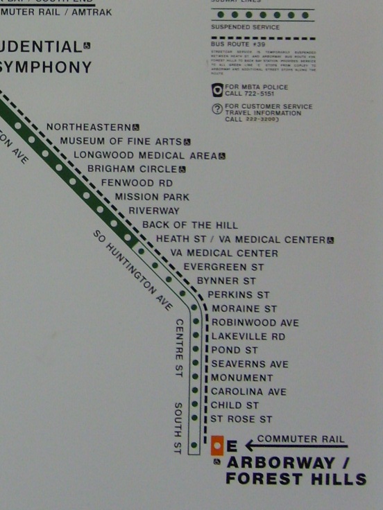
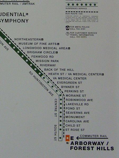
| Description | Map of the Green Line "E" Branch, showing the "suspended" section past Heath Street |
| Date | |
| Source | Photograph of map at Hynes Convention Center station |
| Author | Map created by the MBTA. This photo taken by AutisticPsycho2 |
Licensing edit
| This image of simple geometry is ineligible for copyright and therefore in the public domain, because it consists entirely of information that is common property and contains no original authorship. |  |
File history
Click on a date/time to view the file as it appeared at that time.
| Date/Time | Thumbnail | Dimensions | User | Comment | |
|---|---|---|---|---|---|
| current | 07:36, 12 May 2008 | | 552 × 736 (162 KB) | AutisticPsycho2 (talk | contribs) | {{Information |Description=Map of the E branch at Hynes showing the suspended service |Source=self-made |Date=5/10/2008 |Author= AutisticPsycho2 |Permission=CC-BY-SA 3.0 |other_versions= }} |
You cannot overwrite this file.
File usage on Commons
There are no pages that use this file.
File usage on other wikis
The following other wikis use this file:
- Usage on zh.wikipedia.org