File:Heaven Cave (43891560).jpeg
Original file (2,048 × 1,366 pixels, file size: 1,003 KB, MIME type: image/jpeg)
Captions
Captions
Summary
edit.jpeg&action=edit§ion=1)
| Heaven Cave | |
|---|---|
| Photographer | |
| Title |
Heaven Cave |
| Description |
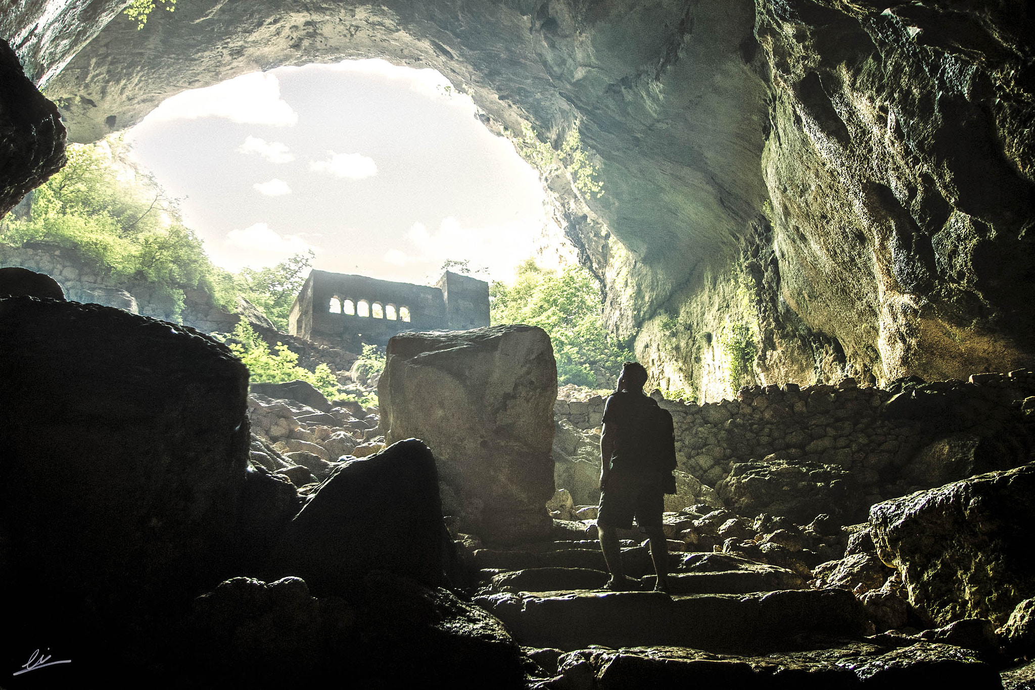
500px provided description: Cennet and Cehennem Cennet Cennet and Cehennem (English: heaven and hell) are the names of two big sinkholes on the Toros Mountains, in Mersin Province, Turkey. The sinkholes are among the touristic attractions of the province. Cennet and Cehennem are situated next to each other. Cennet is situated at 36?27?09?N 34?6?20?E Cehennem on the other hand is at 36?27?16?N 34?6?21?E . Both of them are in the rural area of Silifke district which in turn is a part of Mersin Province. They are accessible by a 2 kilometres (1.2 mi) all season open road from the main high way (D 400) . The highway distances are 22 kilometres (14 mi) to Silifke and 67 kilometres (42 mi) to Mersin. They are close to Narl?kuyu coastal town. Cennet The monastery Top opening of Cennet is 250 x 110 m2 ( 820 x 360 ft2 ) and its average dept is 70 metres (230 ft). It is possible to reach the bottom of Cennet by a primitive staircase composed of 300 steps. At the bottom towards south, there is a smaller and 150 steps deeper cave. In this cave are the ruins of a monastery built in the 5th century by a certain Paulus and dedicated to Virgin Mary. In this monastery one can hear the sound of a small underground stream from the monastery to the gulf of Narl?kuyu. [] |
| Date | 21 August 2013, 21:44:01 (UTC) |
| Source | Imported from 500px (archived version) by the Archive Team. (detail page) |
| Permission (Reusing this file) |
This file is licensed under the Creative Commons Attribution-Share Alike 3.0 Unported license.
|
| Camera location | | View this and other nearby images on: OpenStreetMap |
|---|
.jpeg¶ms=036.449778_N_0034.102736_E_globe:Earth_type:camera__&language=en)
File history
Click on a date/time to view the file as it appeared at that time.
| Date/Time | Thumbnail | Dimensions | User | Comment | |
|---|---|---|---|---|---|
| current | 22:17, 4 August 2018 | | 2,048 × 1,366 (1,003 KB) | DarwIn (talk | contribs) | Photo Heaven Cave imported from 500px with import-500px |
You cannot overwrite this file.
File usage on Commons
The following page uses this file:
.jpeg)
.jpeg&oldid=711096231)