File:Heinrich Johan Holmberg, Karte des Russischen Amerika (1854).jpg

Original file (5,000 × 3,397 pixels, file size: 1.36 MB, MIME type: image/jpeg)
Captions
Captions
Summary edit
.jpg&action=edit§ion=1)
| Description |
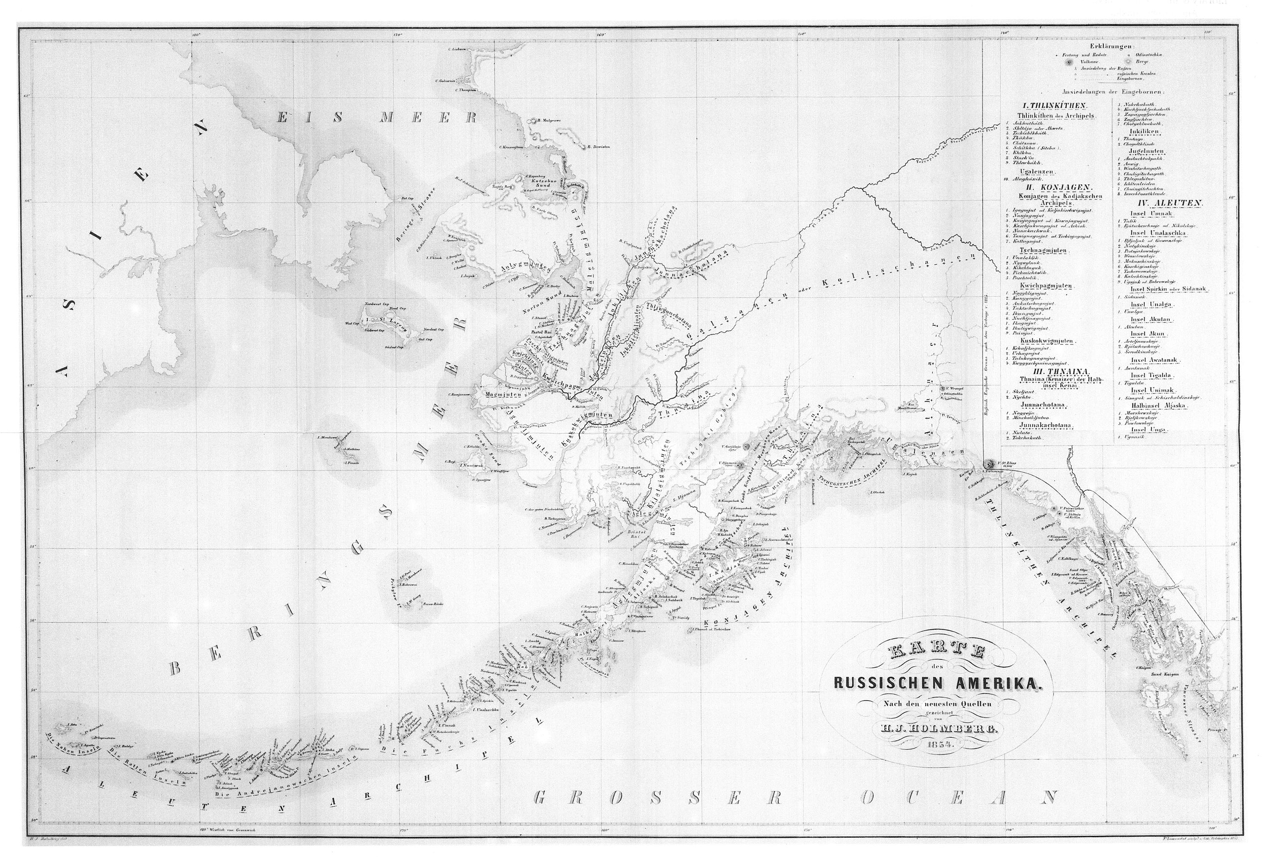
English: Heinrich (or Henrik) Johan Holmberg's 1854 Karte des Russischen Amerika (Map of Russian America). Holmberg was a Finnish geologist, ethnographer, and Inspector for Fish Culture: see David M. Damkaer (2002) The Copepodologist's Cabinet: A Biographical and Bibliographical History, Philadelphia, Penn.: American Philosophical Society, p. 268 ISBN 978-0-871-69240-5 The map is a scan of a copy from a 1985 English translation of the original 1856 source. |
| Date | |
| Source | H[einrich] J[ohan] Holmberg (1856). "Ethnographische Skizzen uber die Völker des Russischen Amerika [Ethnographic Sketches about the People of Russian America]". Acta Societatis Scientiarum Fennicae 4: 282–421. Translated into English as H[einrich] J[ohan] Holmberg; Marvin W. Falk, ed.; Fritz Jaensch, trans. (1985) Holmberg's Ethnographic Sketches [Rasmuson Library historical translation series; vol. 1], Fairbanks: University of Alaska Press ISBN 978-0-912-00617-8 |
| Author | Heinrich (Henrik) Johan Holmberg (1818–1864): see Damkaer, p. 268. |
Licensing edit
.jpg&action=edit§ion=2)
This image is in the public domain because it is a mere mechanical scan or photocopy of a public domain original, or – from the available evidence – is so similar to such a scan or photocopy that no copyright protection can be expected to arise. The original itself is in the public domain for the following reason:
This tag is designed for use where there may be a need to assert that any enhancements (eg brightness, contrast, colour-matching, sharpening) are in themselves insufficiently creative to generate a new copyright. It can be used where it is unknown whether any enhancements have been made, as well as when the enhancements are clear but insufficient. For known raw unenhanced scans you can use an appropriate {{PD-old}} tag instead. For usage, see Commons:When to use the PD-scan tag.  | ||||
File history
Click on a date/time to view the file as it appeared at that time.
| Date/Time | Thumbnail | Dimensions | User | Comment | |
|---|---|---|---|---|---|
| current | 19:49, 14 December 2010 | | 5,000 × 3,397 (1.36 MB) | Mbowser (talk | contribs) | A more descriptive file name was provided. |
| 19:42, 14 December 2010 |  | 5,000 × 3,397 (1.36 MB) | Mbowser (talk | contribs) | {{Information |Description={{en|1=This is a scan of Holmberg's 1854 Karte des Russischen Amerika, actually a scan of a copy from the 1985 English translation.}} |Source=Holmberg, H. J. 1856. Ethnographische Skizzen uber die Völker des Russischen Amerika. |
You cannot overwrite this file.
File usage on Commons
The following page uses this file:
- File:Map scan 09.jpg (file redirect)
File usage on other wikis
The following other wikis use this file:
- Usage on ca.wikipedia.org
- Usage on en.wikipedia.org
- Usage on es.wikipedia.org
- Usage on mrj.wikipedia.org
.jpg&oldid=685524358)