File:Helsingin kartta 1932.jpeg

Size of this preview: 764 × 600 pixels. Other resolutions: 306 × 240 pixels | 611 × 480 pixels | 978 × 768 pixels | 1,280 × 1,005 pixels | 2,560 × 2,010 pixels | 5,920 × 4,648 pixels.
Original file (5,920 × 4,648 pixels, file size: 3.3 MB, MIME type: image/jpeg)
Captions
Captions
Add a one-line explanation of what this file represents
| Title |
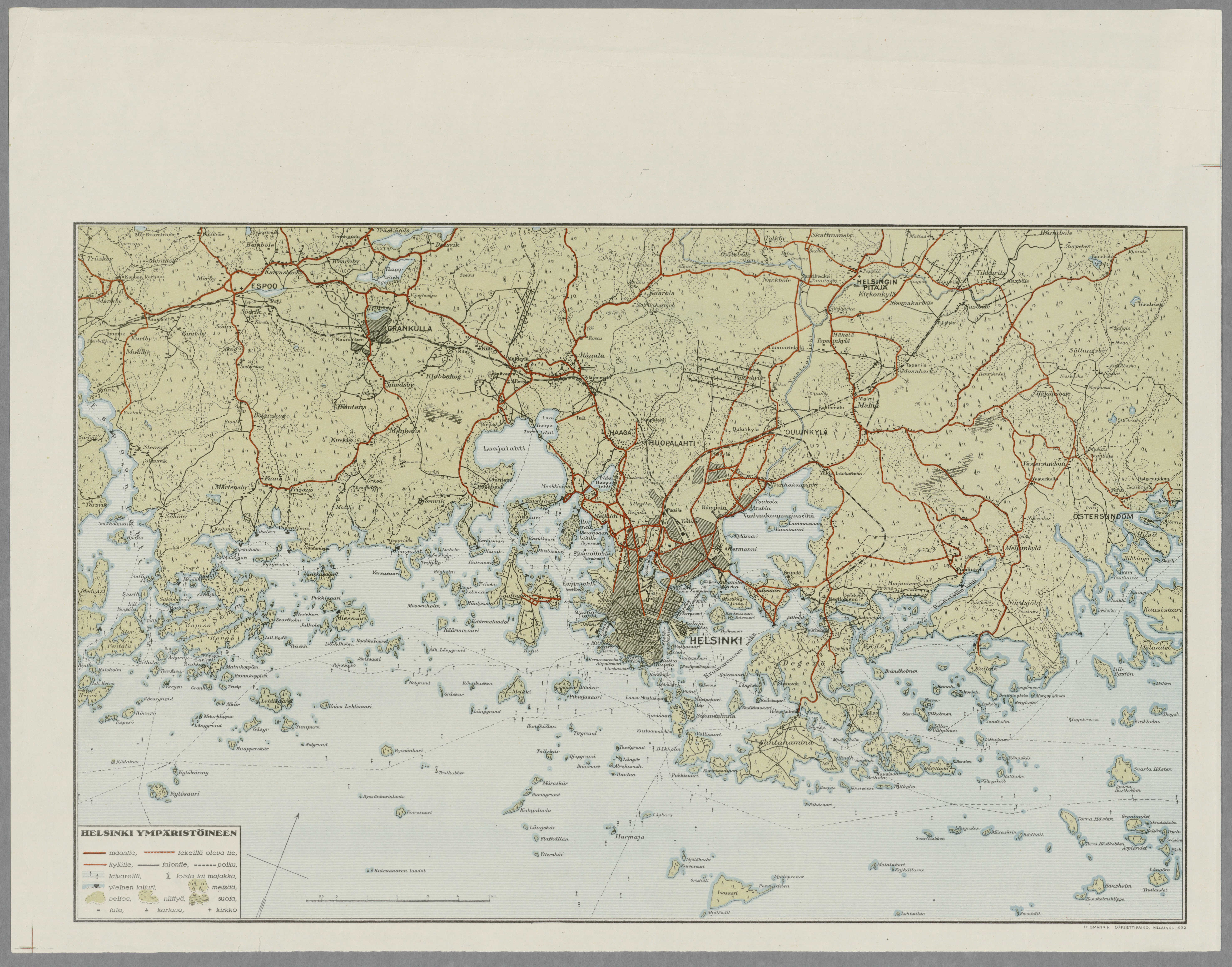
Suomi: Helsinki ympäristöineen, 1932 |
|||||||||||||||||||||||
| Description |
Mittakaavat laskettu janamittakaavasta. Kartat molemmin puolin lehteä. Ison tietosanakirjan IV:n osan liite. Sisältää myös kartakkeen Helsingin lähintä ympäristöä. |
|||||||||||||||||||||||
| Date | ||||||||||||||||||||||||
| Source |
|
|||||||||||||||||||||||
| Permission (Reusing this file) |
|
|||||||||||||||||||||||
| Geotemporal data | ||||||||||||||||||||||||
| Map location | Helsinki | |||||||||||||||||||||||
| Bounding box |
|
|||||||||||||||||||||||
| Georeferencing | ||||||||||||||||||||||||
| Bibliographic data | ||||||||||||||||||||||||
| Publisher |
Otava |
|||||||||||||||||||||||
| Printed by |
Tigmannin offsettipaino, Helsinki |
|||||||||||||||||||||||
| Archival data | ||||||||||||||||||||||||
| Collection |
|
|||||||||||||||||||||||
| Accession number | ||||||||||||||||||||||||

File history
Click on a date/time to view the file as it appeared at that time.
| Date/Time | Thumbnail | Dimensions | User | Comment | |
|---|---|---|---|---|---|
| current | 12:27, 4 February 2015 | | 5,920 × 4,648 (3.3 MB) | Artturimatias (talk | contribs) | |
| 12:23, 4 February 2015 |  | 5,920 × 4,648 (3.3 MB) | Artturimatias (talk | contribs) |
You cannot overwrite this file.
File usage on Commons
The following page uses this file:
File usage on other wikis
The following other wikis use this file:
- Usage on fi.wikipedia.org