File:Hemington Chapel - geograph.org.uk - 1436849.jpg
No higher resolution available.
Hemington_Chapel_-_geograph.org.uk_-_1436849.jpg (640 × 479 pixels, file size: 82 KB, MIME type: image/jpeg)
Captions
Captions
Add a one-line explanation of what this file represents
Summary
edit
| Description |
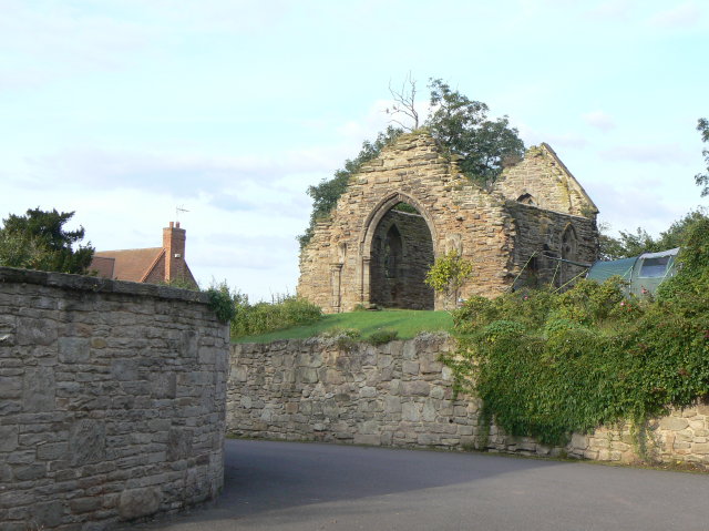
English: Parish church ruins at Hemington, Leicestershire. Out of use since the 16th century, it has become progressively more ruinous. It is still shown on the 1:50000 maps as a 'church with tower', but the latter collapsed in the 1980s. View from the north west; it is now on private land. |
| Date | |
| Source | From geograph.org.uk |
| Author | Alan Murray-Rust |
| Attribution (required by the license) | Alan Murray-Rust / Hemington Chapel / |
| Camera location | | View this and other nearby images on: OpenStreetMap |
|---|
_heading:67.00&language=en)
| Object location | | View this and other nearby images on: OpenStreetMap |
|---|
_heading:67.00&language=en)
Licensing
edit

|
This image was taken from the Geograph project collection. See this photograph's page on the Geograph website for the photographer's contact details. The copyright on this image is owned by Alan Murray-Rust and is licensed for reuse under the Creative Commons Attribution-ShareAlike 2.0 license.
|
This file is licensed under the Creative Commons Attribution-Share Alike 2.0 Generic license.
Attribution: Alan Murray-Rust
- You are free:
- to share – to copy, distribute and transmit the work
- to remix – to adapt the work
- Under the following conditions:
- attribution – You must give appropriate credit, provide a link to the license, and indicate if changes were made. You may do so in any reasonable manner, but not in any way that suggests the licensor endorses you or your use.
- share alike – If you remix, transform, or build upon the material, you must distribute your contributions under the same or compatible license as the original.
File history
Click on a date/time to view the file as it appeared at that time.
| Date/Time | Thumbnail | Dimensions | User | Comment | |
|---|---|---|---|---|---|
| current | 22:53, 1 March 2011 | | 640 × 479 (82 KB) | GeographBot (talk | contribs) | == {{int:filedesc}} == {{Information |description={{en|1=Hemington Chapel Out of use since the sixteenth century it has become progressively more ruinous. Still shown on the 1:50000 maps as a 'church with tower', the latter collapsed in the 1980s. View fr |
You cannot overwrite this file.
File usage on Commons
There are no pages that use this file.