File:Het mallebos vanuit de lucht en Spijkenisse.jpg

Size of this preview: 800 × 450 pixels. Other resolutions: 320 × 180 pixels | 640 × 360 pixels | 1,024 × 576 pixels | 1,280 × 720 pixels | 2,560 × 1,440 pixels | 3,841 × 2,160 pixels.
Original file (3,841 × 2,160 pixels, file size: 8.6 MB, MIME type: image/jpeg)
Captions
Captions
Add a one-line explanation of what this file represents
Summary edit
| Description |
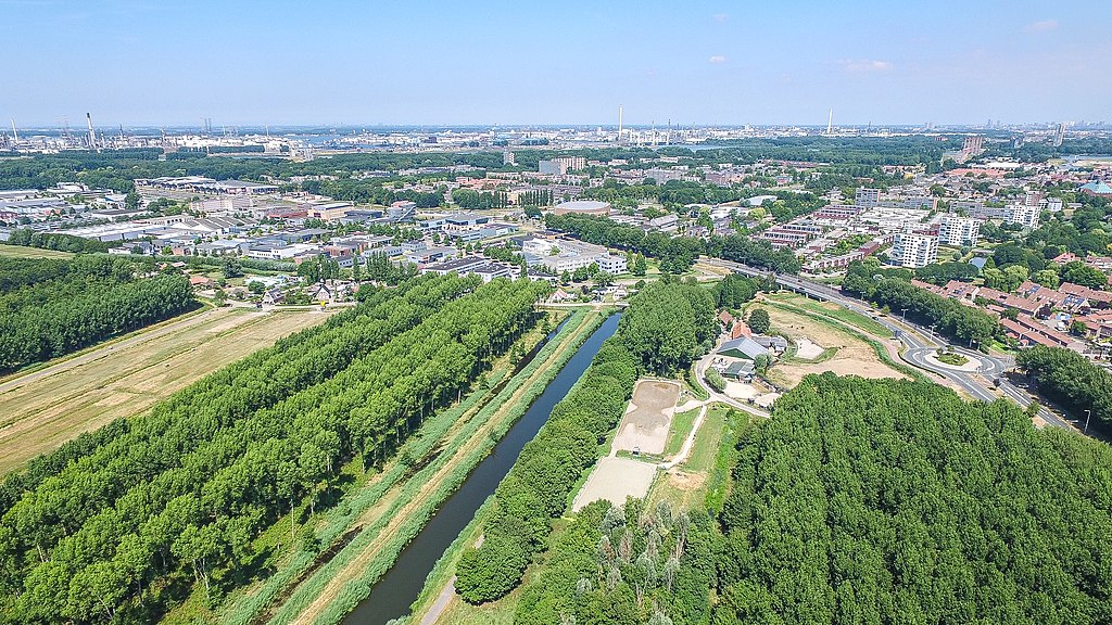
English: Spijkenisse from the air with a drone
Nederlands: Spijkenisse vanuit de lucht met een drone: links het Mallebos, dan de Vierambachtenboezem en rechts Park Vogelenzang. Daarboven bedrijventerrein Halfweg-Molenwatering en de Baljuwlaan. Rechts een stukje van wijk De Hoek (met rode daken), daarnaast de wijk Vierambachten. Aan de horizon industriegebied de Botlek. |
| Date | |
| Source | Own work |
| Author | Peter van der Sluijs |
| Camera location | | View this and other nearby images on: OpenStreetMap |
|---|
Licensing edit
I, the copyright holder of this work, hereby publish it under the following licenses:

|
Permission is granted to copy, distribute and/or modify this document under the terms of the GNU Free Documentation License, Version 1.2 or any later version published by the Free Software Foundation; with no Invariant Sections, no Front-Cover Texts, and no Back-Cover Texts. A copy of the license is included in the section entitled GNU Free Documentation License. |
This file is licensed under the Creative Commons Attribution-Share Alike 4.0 International, 3.0 Unported, 2.5 Generic, 2.0 Generic and 1.0 Generic license.
- You are free:
- to share – to copy, distribute and transmit the work
- to remix – to adapt the work
- Under the following conditions:
- attribution – You must give appropriate credit, provide a link to the license, and indicate if changes were made. You may do so in any reasonable manner, but not in any way that suggests the licensor endorses you or your use.
- share alike – If you remix, transform, or build upon the material, you must distribute your contributions under the same or compatible license as the original.
You may select the license of your choice.
File history
Click on a date/time to view the file as it appeared at that time.
| Date/Time | Thumbnail | Dimensions | User | Comment | |
|---|---|---|---|---|---|
| current | 13:03, 28 July 2018 | | 3,841 × 2,160 (8.6 MB) | Dodoman (talk | contribs) | {{Information |description ={{en|1=Spijkenisse from the air with a drone}} {{nl|1=Spijkenisse vanuit de lucht met een drone}} |date =2018-07-28 |source ={{own}} |author =Peter van der Sluijs }} Category:Spijkenisse Category:Mallebos Category:Nature of Spijkenisse |
You cannot overwrite this file.
File usage on Commons
There are no pages that use this file.