File:Hey Edge Ordnance Survey Triangulation Pillar - geograph.org.uk - 436861.jpg
No higher resolution available.
Hey_Edge_Ordnance_Survey_Triangulation_Pillar_-_geograph.org.uk_-_436861.jpg (640 × 353 pixels, file size: 57 KB, MIME type: image/jpeg)
Captions
Captions
Add a one-line explanation of what this file represents
Summary
edit
| Description |
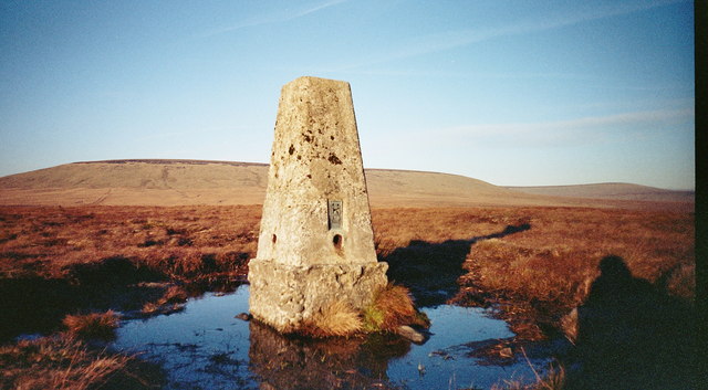
English: Hey Edge Ordnance Survey Triangulation Pillar The Flush Bracket Base Plate number is S2640. Unusually, the pillar is not shown as a blue triangle on Ordnance survey maps; this is because although the Ordnance Survey obviously built it, they never actually took observations from here.
Deutsch: Triangulations-Messpfeiler für die Artillerie. Die Nummer an der Basis des Pfeilers ist S2640. Unüblicherweise ist die Säule nicht als blaues Dreieck auf den Artilleriekarten verzeichnet, sie wurde ganz offensichtlich für die Artillerievermessung erbaut, jedoch nie wirklich benutzt. |
| Date | |
| Source | From geograph.org.uk |
| Author | Manchester Warrior |
| Attribution (required by the license) | Manchester Warrior / Hey Edge Ordnance Survey Triangulation Pillar / |
| Camera location | | View this and other nearby images on: OpenStreetMap |
|---|
_heading:45.00&language=en)
| Object location | | View this and other nearby images on: OpenStreetMap |
|---|
_heading:45.00&language=en)
Licensing
edit

|
This image was taken from the Geograph project collection. See this photograph's page on the Geograph website for the photographer's contact details. The copyright on this image is owned by Manchester Warrior and is licensed for reuse under the Creative Commons Attribution-ShareAlike 2.0 license.
|
This file is licensed under the Creative Commons Attribution-Share Alike 2.0 Generic license.
Attribution: Manchester Warrior
- You are free:
- to share – to copy, distribute and transmit the work
- to remix – to adapt the work
- Under the following conditions:
- attribution – You must give appropriate credit, provide a link to the license, and indicate if changes were made. You may do so in any reasonable manner, but not in any way that suggests the licensor endorses you or your use.
- share alike – If you remix, transform, or build upon the material, you must distribute your contributions under the same or compatible license as the original.
File history
Click on a date/time to view the file as it appeared at that time.
| Date/Time | Thumbnail | Dimensions | User | Comment | |
|---|---|---|---|---|---|
| current | 07:59, 4 February 2011 | | 640 × 353 (57 KB) | GeographBot (talk | contribs) | == {{int:filedesc}} == {{Information |description={{en|1=Hey Edge Ordnance Survey Triangulation Pillar The Flush Bracket Base Plate number is S2640. Unusually, the pillar is not shown as a blue triangle on Ordnance survey maps; this is because although th |
You cannot overwrite this file.
File usage on Commons
There are no pages that use this file.