File:High Street - geograph.org.uk - 421964.jpg
No higher resolution available.
High_Street_-_geograph.org.uk_-_421964.jpg (640 × 360 pixels, file size: 76 KB, MIME type: image/jpeg)
Captions
Captions
Add a one-line explanation of what this file represents
Summary edit
| Description |
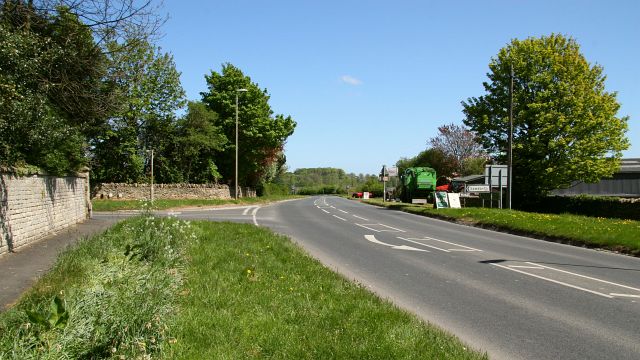
English: The photograph shows the eastern end of High Street (A170), Brompton-By-Sawdon, which ends at the road junction, ahead left. The junction is with 422026, which leads to Sawdon. Behind the viewpoint on the right is the junction with Hungate. Ahead the A170 continues as Main Road toward Ruston whilst behind the viewpoint the road is from Snainton. For a more easterly (ahead) photograph of the A170, click here 422004. For a more westerly (behind the viewpoint) photograph of High Street, click here 421944. |
||
| Date | |||
| Source | From geograph.org.uk | ||
| Author | Alan Walker | ||
| Permission (Reusing this file) |
This file is licensed under the Creative Commons Attribution-Share Alike 2.0 Generic license. Attribution: Alan Walker
|
||
| Other versions |
|
||
| Attribution (required by the license) | Alan Walker / High Street / | ||


| Camera location | | View this and other nearby images on: OpenStreetMap |
|---|
_heading:67.00&language=en)
| Object location | | View this and other nearby images on: OpenStreetMap |
|---|
_heading:67.00&language=en)
File history
Click on a date/time to view the file as it appeared at that time.
| Date/Time | Thumbnail | Dimensions | User | Comment | |
|---|---|---|---|---|---|
| current | 04:36, 4 February 2011 | | 640 × 360 (76 KB) | GeographBot (talk | contribs) | == {{int:filedesc}} == {{Information |description={{en|1=High Street The photograph shows the eastern end of High Street (A170), Brompton-By-Sawdon, which ends at the road junction, ahead left. The junction is with 422026, which leads to Sawdon. Beh |
You cannot overwrite this file.
File usage on Commons
The following page uses this file: