File:High slopes below the Saddle - geograph.org.uk - 773121.jpg

Size of this preview: 800 × 516 pixels. Other resolutions: 320 × 206 pixels | 640 × 413 pixels | 1,000 × 645 pixels.
Original file (1,000 × 645 pixels, file size: 1.03 MB, MIME type: image/jpeg)
Captions
Captions
Add a one-line explanation of what this file represents
Summary
edit
| Description |
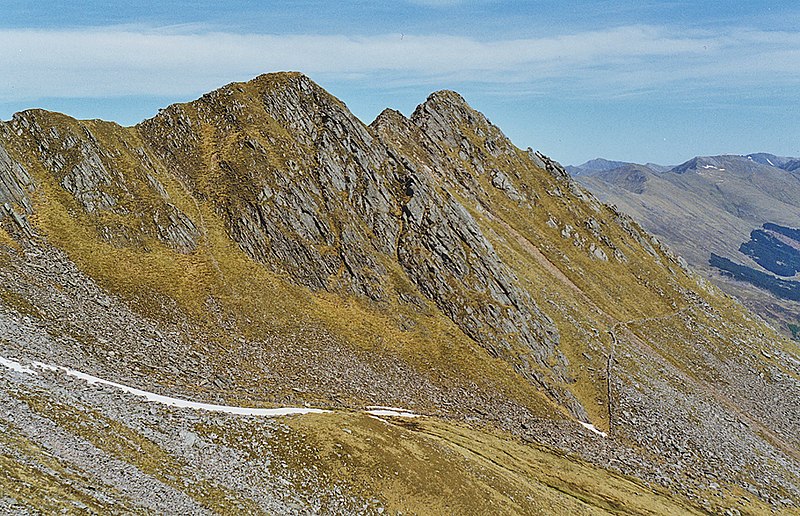
English: High slopes below the Saddle These fall south east from the summit, mixing scree and large areas of moss. Beyond lies the ridge leading out to Sgurr nan Forcan; beneath it on the right is an ancient wall which contours under the ridge before turning sharp right towards the summit of the Saddle. |
| Date | |
| Source | From geograph.org.uk |
| Author | Nigel Brown |
| Attribution (required by the license) | Nigel Brown / High slopes below the Saddle / |
| Camera location | | View this and other nearby images on: OpenStreetMap |
|---|
_heading:67.00&language=en)
| Object location | | View this and other nearby images on: OpenStreetMap |
|---|
_heading:67.00&language=en)
Licensing
edit

|
This image was taken from the Geograph project collection. See this photograph's page on the Geograph website for the photographer's contact details. The copyright on this image is owned by Nigel Brown and is licensed for reuse under the Creative Commons Attribution-ShareAlike 2.0 license.
|
This file is licensed under the Creative Commons Attribution-Share Alike 2.0 Generic license.
Attribution: Nigel Brown
- You are free:
- to share – to copy, distribute and transmit the work
- to remix – to adapt the work
- Under the following conditions:
- attribution – You must give appropriate credit, provide a link to the license, and indicate if changes were made. You may do so in any reasonable manner, but not in any way that suggests the licensor endorses you or your use.
- share alike – If you remix, transform, or build upon the material, you must distribute your contributions under the same or compatible license as the original.
- Remove redundant categories and try to put this image in the most specific category/categories
- Remove this template
- The location categories are based on information from this geonames tool and this OpenStreetMap tool combined with a database. You can also have a look at this tool from mysociety.
- The topic category from Geograph was Mountainside (find similar images at Geograph)
File history
Click on a date/time to view the file as it appeared at that time.
| Date/Time | Thumbnail | Dimensions | User | Comment | |
|---|---|---|---|---|---|
| current | 15:41, 16 May 2020 | | 1,000 × 645 (1.03 MB) | Geograph Update Bot (talk | contribs) | Higher-resolution version from Geograph. |
| 22:02, 19 February 2011 |  | 640 × 413 (107 KB) | GeographBot (talk | contribs) | == {{int:filedesc}} == {{Information |description={{en|1=High slopes below the Saddle These fall south east from the summit, mixing scree and large areas of moss. Beyond lies the ridge leading out to Sgurr nan Forcan; beneath it on the right is an ancient |
You cannot overwrite this file.
File usage on Commons
There are no pages that use this file.