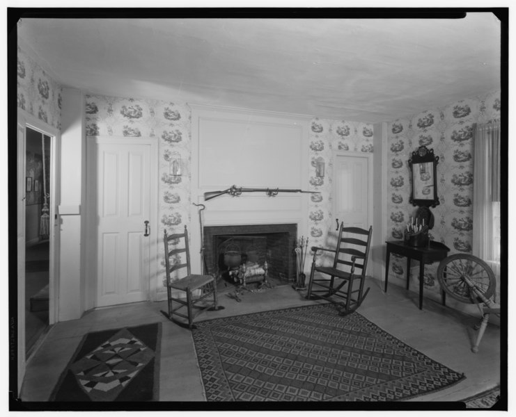
File:Historic American Buildings Survey, FIREPLACE WALL, DINING ROOM. - General Nathanael Greene House, Greene Street, Anthony, Coventry, Kent County, RI HABS RI,2-ANTH,1-2.tif
Size of this JPG preview of this TIF file: 741 × 600 pixels. Other resolutions: 297 × 240 pixels | 593 × 480 pixels | 949 × 768 pixels | 1,265 × 1,024 pixels | 2,530 × 2,048 pixels | 5,000 × 4,047 pixels.
Original file (5,000 × 4,047 pixels, file size: 19.3 MB, MIME type: image/tiff)
Captions
Captions
Add a one-line explanation of what this file represents
Summary edit
| Historic American Buildings Survey, FIREPLACE WALL, DINING ROOM. - General Nathanael Greene House, Greene Street, Anthony, Coventry, Kent County, RI | ||||
|---|---|---|---|---|
| Title |
Historic American Buildings Survey, FIREPLACE WALL, DINING ROOM. - General Nathanael Greene House, Greene Street, Anthony, Coventry, Kent County, RI |
|||
| Description |
Greene, Nathanael; Nathanael Greene Homestead Association |
|||
| Depicted place | Rhode Island; Kent County; Anthony, Coventry | |||
| Date | Documentation compiled after 1933 | |||
| Dimensions | height: 8 in (20.3 cm); width: 10 in (25.4 cm) | |||
| Current location |
Library of Congress Prints and Photographs Division Washington, D.C. 20540 USA http://hdl.loc.gov/loc.pnp/pp.print |
|||
| Accession number |
HABS RI,2-ANTH,1-2 |
|||
| Credit line |
|
|||
| Notes |
|
|||
| References |
|
|||
| Source | https://www.loc.gov/pictures/item/ri0014.photos.144221p | |||
| Permission (Reusing this file) |
|
|||

File history
Click on a date/time to view the file as it appeared at that time.
| Date/Time | Thumbnail | Dimensions | User | Comment | |
|---|---|---|---|---|---|
| current | 13:41, 1 August 2014 |  | 5,000 × 4,047 (19.3 MB) | Fæ (talk | contribs) | GWToolset: Creating mediafile for Fæ. HABS 31 July 2014 (3000:3200) |
You cannot overwrite this file.
File usage on Commons
The following page uses this file:
File usage on other wikis
The following other wikis use this file:
- Usage on en.wikipedia.org