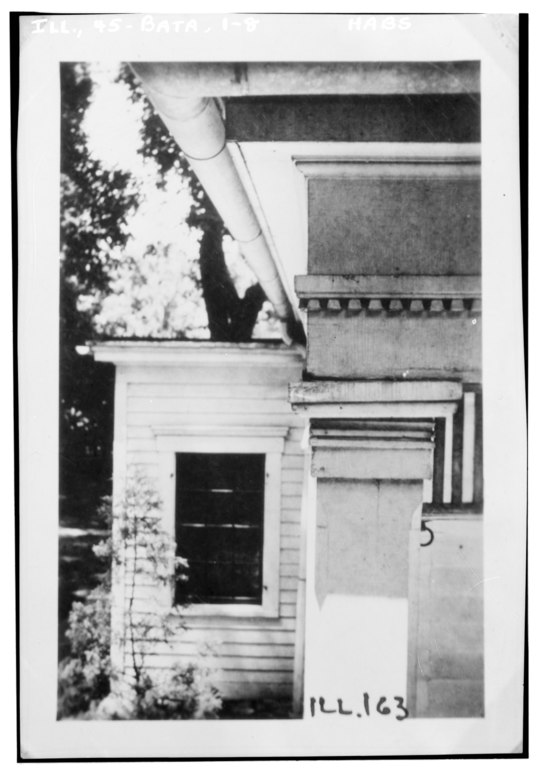
File:Historic American Buildings Survey C. Magro, Photographer July 8, 1936. FRONT PORCH COLUMN CAPS - Burke House, Washington Street, Batavia, Kane County, IL HABS ILL,45-BATA,1-8.tif

Size of this JPG preview of this TIF file: 421 × 599 pixels. Other resolutions: 169 × 240 pixels | 337 × 480 pixels | 540 × 768 pixels | 720 × 1,024 pixels | 1,440 × 2,048 pixels | 3,515 × 5,000 pixels.
Original file (3,515 × 5,000 pixels, file size: 16.76 MB, MIME type: image/tiff)
Captions
Captions
Add a one-line explanation of what this file represents
Summary edit
| Historic American Buildings Survey C. Magro, Photographer July 8, 1936. FRONT PORCH COLUMN CAPS - Burke House, Washington Street, Batavia, Kane County, IL | ||||
|---|---|---|---|---|
| Photographer |
Related names:
|
|||
| Title |
Historic American Buildings Survey C. Magro, Photographer July 8, 1936. FRONT PORCH COLUMN CAPS - Burke House, Washington Street, Batavia, Kane County, IL |
|||
| Depicted place | Illinois; Kane County; Batavia | |||
| Date | Documentation compiled after 1933 | |||
| Dimensions | 4 x 5 in. | |||
| Current location |
Library of Congress Prints and Photographs Division Washington, D.C. 20540 USA http://hdl.loc.gov/loc.pnp/pp.print |
|||
| Accession number |
HABS ILL,45-BATA,1-8 |
|||
| Credit line |
|
|||
| Notes |
|
|||
| Source | https://www.loc.gov/pictures/item/il0185.photos.062472p | |||
| Permission (Reusing this file) |
|
|||

| Camera location | | View this and other nearby images on: OpenStreetMap |
|---|
File history
Click on a date/time to view the file as it appeared at that time.
| Date/Time | Thumbnail | Dimensions | User | Comment | |
|---|---|---|---|---|---|
| current | 13:43, 16 July 2014 |  | 3,515 × 5,000 (16.76 MB) | Fæ (talk | contribs) | GWToolset: Creating mediafile for Fæ. HABS 11 July 2014 (1001:1200) |
You cannot overwrite this file.
File usage on Commons
The following page uses this file: