File:Hitotsuse power station survey 1976.jpg
No higher resolution available.
Hitotsuse_power_station_survey_1976.jpg (690 × 516 pixels, file size: 96 KB, MIME type: image/jpeg)
Captions
Captions
Add a one-line explanation of what this file represents
Summary edit
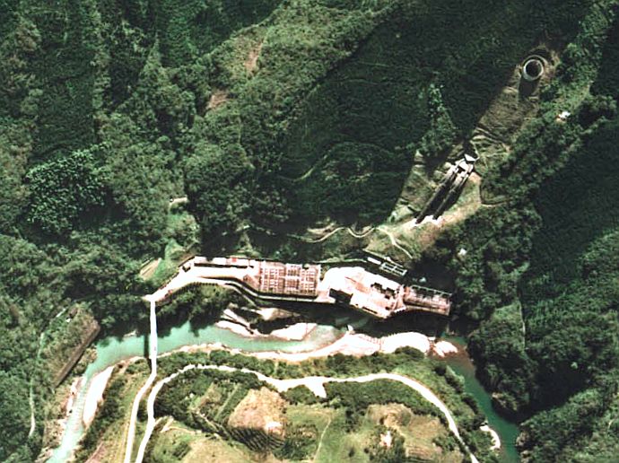
Aerial Photo of Hitotsuse power station (1976), Saito city, Miyazaki prefecture, Japan.
日本語: 一ツ瀬発電所の航空写真。1976年度撮影。
Licensing edit

|
The copyright holder of this file, the Ministry of Land, Infrastructure, Transport and Tourism of Japan, allows anyone to use it for any purpose, provided that the copyright holder is properly attributed. Redistribution, derivative work, commercial use, and all other use is permitted. |
Attribution:
Copyright © National Land Image Information (Color Aerial Photographs), Ministry of Land, Infrastructure, Transport and Tourism
|
 |
This image is copyrighted by the Ministry of Land, Infrastructure, Transport and Tourism of Japan. For terms of use, see the stipulation to use of National Land Information (in Japanese) and message from MLIT (in Japanese and English). When you display this image on an article, include the following phrase in the description: "Made based on National Land Image Information (Color Aerial Photographs), Ministry of Land, Infrastructure, Transport and Tourism".
|
File history
Click on a date/time to view the file as it appeared at that time.
| Date/Time | Thumbnail | Dimensions | User | Comment | |
|---|---|---|---|---|---|
| current | 08:57, 21 February 2008 | | 690 × 516 (96 KB) | Qurren (talk | contribs) | Aerial Photo of Hitotsuse power station (1976), Saito city, Miyazaki prefecture, Japan. {{ja|一ツ瀬発電所の航空写真。1976年度撮影。}} == Licensing == {{AerialPhotograph-mlitJP}} [[Category:Hydroelectric powerplan |
You cannot overwrite this file.
File usage on Commons
There are no pages that use this file.
File usage on other wikis
The following other wikis use this file:
- Usage on uk.wikipedia.org